ملف:Skyline High School Campus Map.png
حجم هذه المعاينة: 757 × 600 بكسل. البعدان الآخران: 2٬560 × 2٬028 بكسل | 2٬620 × 2٬076 بكسل.
الملف الأصلي (2٬620 × 2٬076 بكسل حجم الملف: 232 كيلوبايت، نوع MIME: image/png)

|
[All images in this gallery should be recreated using vector graphics as an SVG file. This has several advantages; see Commons:Media for cleanup for more information. If an SVG form of this image is already available, please upload it. After uploading an SVG, replace this template with {{vector version available|new image name.svg}}.] Error: {{Lang}}: text has italic markup (help) |
|
العربية | български | català | čeština | dansk | Deutsch | English | Esperanto | español | français | galego | 한국어 | italiano | magyar | lietuvių | 日本語 | Plattdüütsch | Nederlands | norsk | polski | português | română | русский | suomi | svenska | Türkçe | українська | 中文(繁體) | 中文(简体) | +/− | |
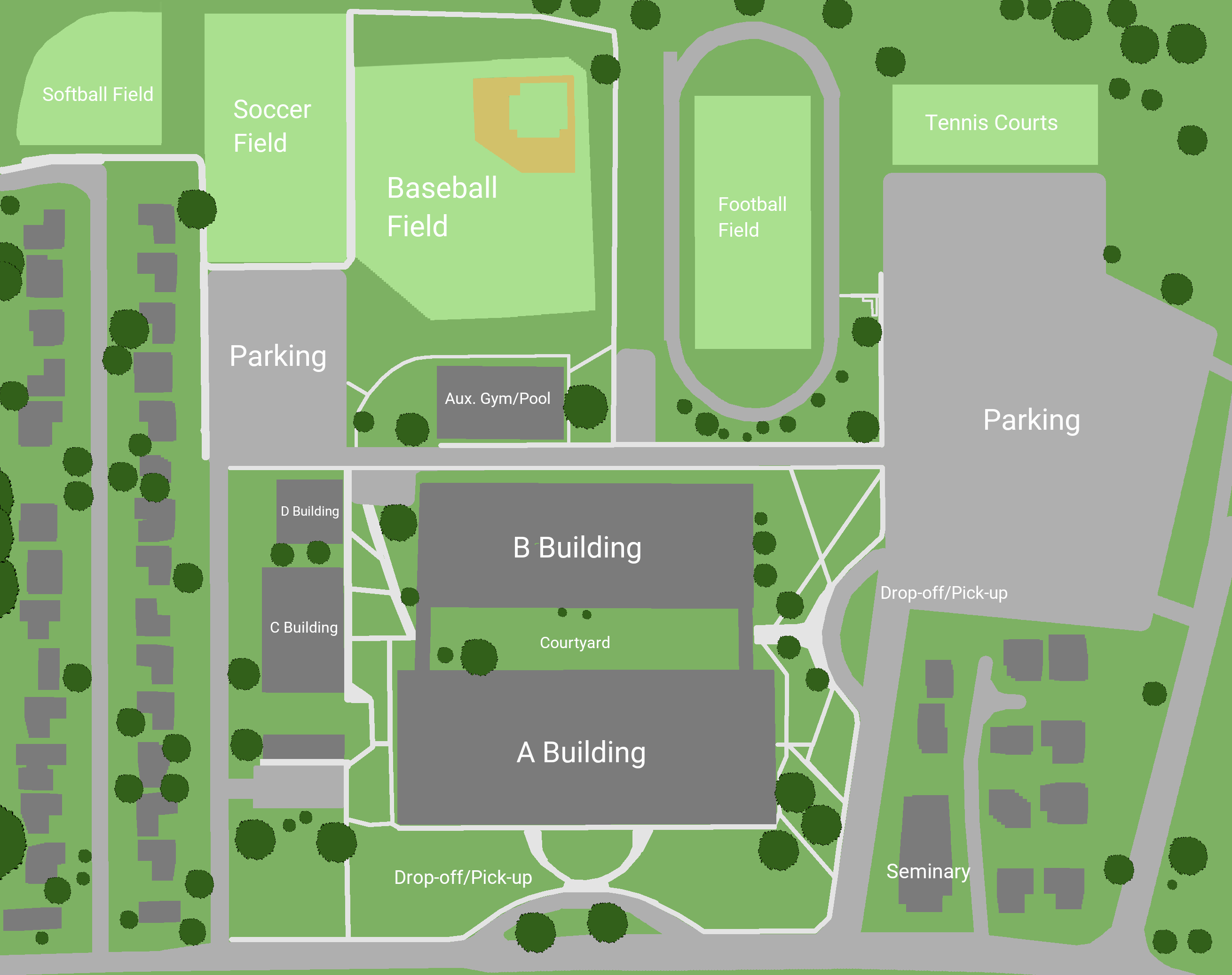
وصف قصير
| Description |
English: Skyline High School campus map |
| Date | 2020-05-21 |
| Source | Own work |
| Author | Grant Handy |
| ⧼wm-license-information-permission⧽ (⧼wm-license-information-permission-reusing-text⧽) |
This is licensed under the Creative Commons 4.0 Share-Alike License. You are welcome to print off this map and use it to navigate the school. |
ترخيص
|
تاريخ الملف
اضغط على زمن/تاريخ لرؤية الملف كما بدا في هذا الزمن.
| زمن/تاريخ | صورة مصغرة | الأبعاد | مستخدم | تعليق | |
|---|---|---|---|---|---|
| حالي | ★ مراجعة معتمدة 09:29، 1 ديسمبر 2023 | | 2٬620 × 2٬076 (232 كيلوبايت) | Pastakhov (نقاش | مساهمات) | Upload https://upload.wikimedia.org/wikipedia/commons/9/92/Skyline_High_School_Campus_Map.png |
لا يمكنك استبدال هذا الملف.
وصلات
لا يوجد صفحات تصل لهذه الصورة.