ملف:Reserva Nacional de Paracas topographic map-es.png
حجم هذه المعاينة: 489 × 600 بكسل. البعد الآخر: 989 × 1٬213 بكسل.
الملف الأصلي (989 × 1٬213 بكسل حجم الملف: 595 كيلوبايت، نوع MIME: image/png)
| Description |
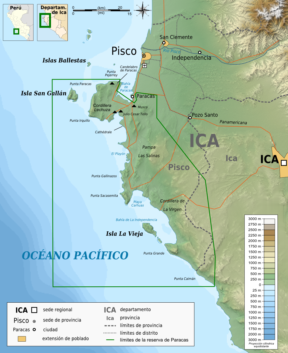
Français : Carte topographique en espagnol de la Réserve nationale de Paracas Deutsch: Topographische Karte zum Réserve nationale de Paracas, in Spanische English: Topographic map in Spanish of the Paracas National Reservation Español: Mapa topográfico en español de la Reserva Nacional de Paracas |
|||
| Date | 2010-01-15 | |||
| Source |
English: Own work ;
Français : Création personnelle ;
|
|||
| Author | Bourrichon - fr:Bourrichon | |||
| ⧼wm-license-information-permission⧽ (⧼wm-license-information-permission-reusing-text⧽) |
|
|||
| ⧼wm-license-information-other-versions⧽ | قالب:Other versions/Reserva Nacional de Paracas map |

.svg&action=edit&redlink=1)
|
|
This image was created with Inkscape. |
تاريخ الملف
اضغط على زمن/تاريخ لرؤية الملف كما بدا في هذا الزمن.
| زمن/تاريخ | صورة مصغرة | الأبعاد | مستخدم | تعليق | |
|---|---|---|---|---|---|
| حالي | ★ مراجعة معتمدة 12:35، 27 أكتوبر 2023 | | 989 × 1٬213 (595 كيلوبايت) | Pastakhov (نقاش | مساهمات) | Upload https://upload.wikimedia.org/wikipedia/commons/b/bf/Reserva_Nacional_de_Paracas_topographic_map-es.png |
لا يمكنك استبدال هذا الملف.
وصلات
لا يوجد صفحات تصل لهذه الصورة.