ملف:Port of Rotterdam Landsat 8 Photo 8 May 2016.jpg
حجم هذه المعاينة: 800 × 252 بكسل. البعد الآخر: 5٬016 × 1٬578 بكسل.
الملف الأصلي (5٬016 × 1٬578 بكسل حجم الملف: 6٫73 ميجابايت، نوع MIME: image/jpeg)
وصف قصير
| Description |
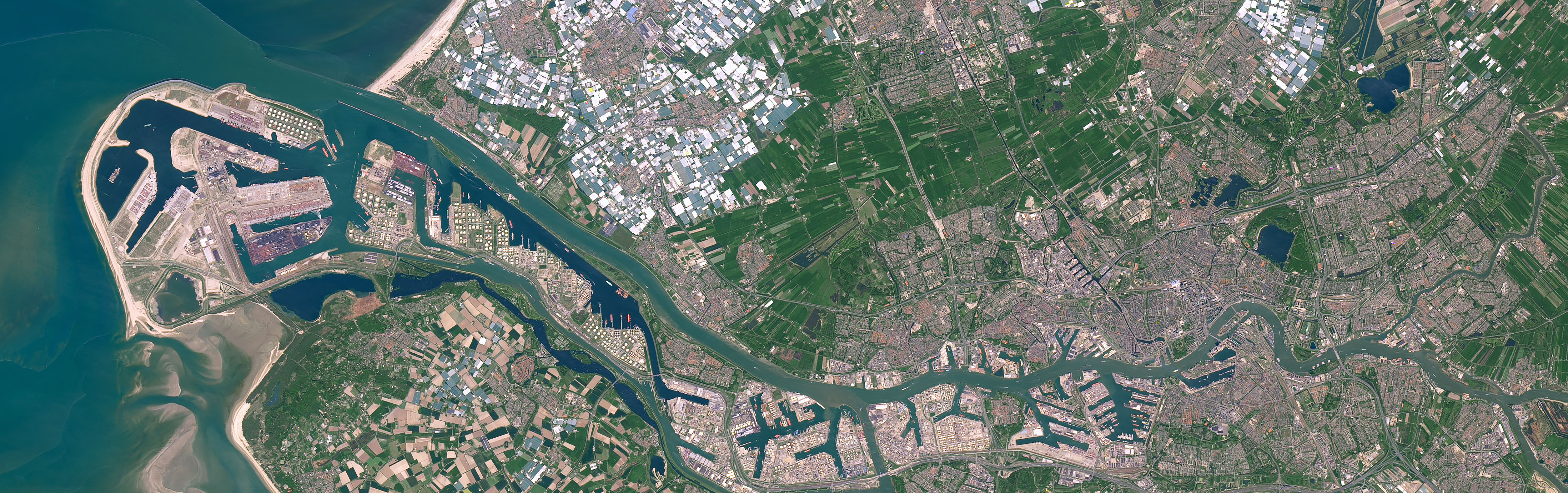
English: Satellite photo of the Port of Rotterdam in South Holland, the Netherlands. This image was captured on May 8, 2016 by the Operational Land Imager (OLI) on the Landsat 8 satellite.
(Dutch) |
| Date | 2016-05-08 |
| Source | NASA Earth Observatory - https://earthobservatory.nasa.gov/images/91317/holland-first-stop-for-the-pilgrims |
| Author | NASA Earth Observatory images by Joshua Stevens, using Landsat data from the U.S. Geological Survey. Story by Adam Voiland. |
ترخيص
تاريخ الملف
اضغط على زمن/تاريخ لرؤية الملف كما بدا في هذا الزمن.
| زمن/تاريخ | صورة مصغرة | الأبعاد | مستخدم | تعليق | |
|---|---|---|---|---|---|
| حالي | ★ مراجعة معتمدة 14:47، 14 أكتوبر 2023 | 5٬016 × 1٬578 (6٫73 ميجابايت) | Pastakhov (نقاش | مساهمات) | Upload https://upload.wikimedia.org/wikipedia/commons/3/34/Port_of_Rotterdam_Landsat_8_Photo_8_May_2016.jpg |
لا يمكنك استبدال هذا الملف.
وصلات
لا يوجد صفحات تصل لهذه الصورة.