ملف:Ophelia 2005-09-14 1605Z (alternate).jpg
الملف الأصلي (4٬800 × 6٬000 بكسل حجم الملف: 4٫86 ميجابايت، نوع MIME: image/jpeg)
وصف قصير
| Description |
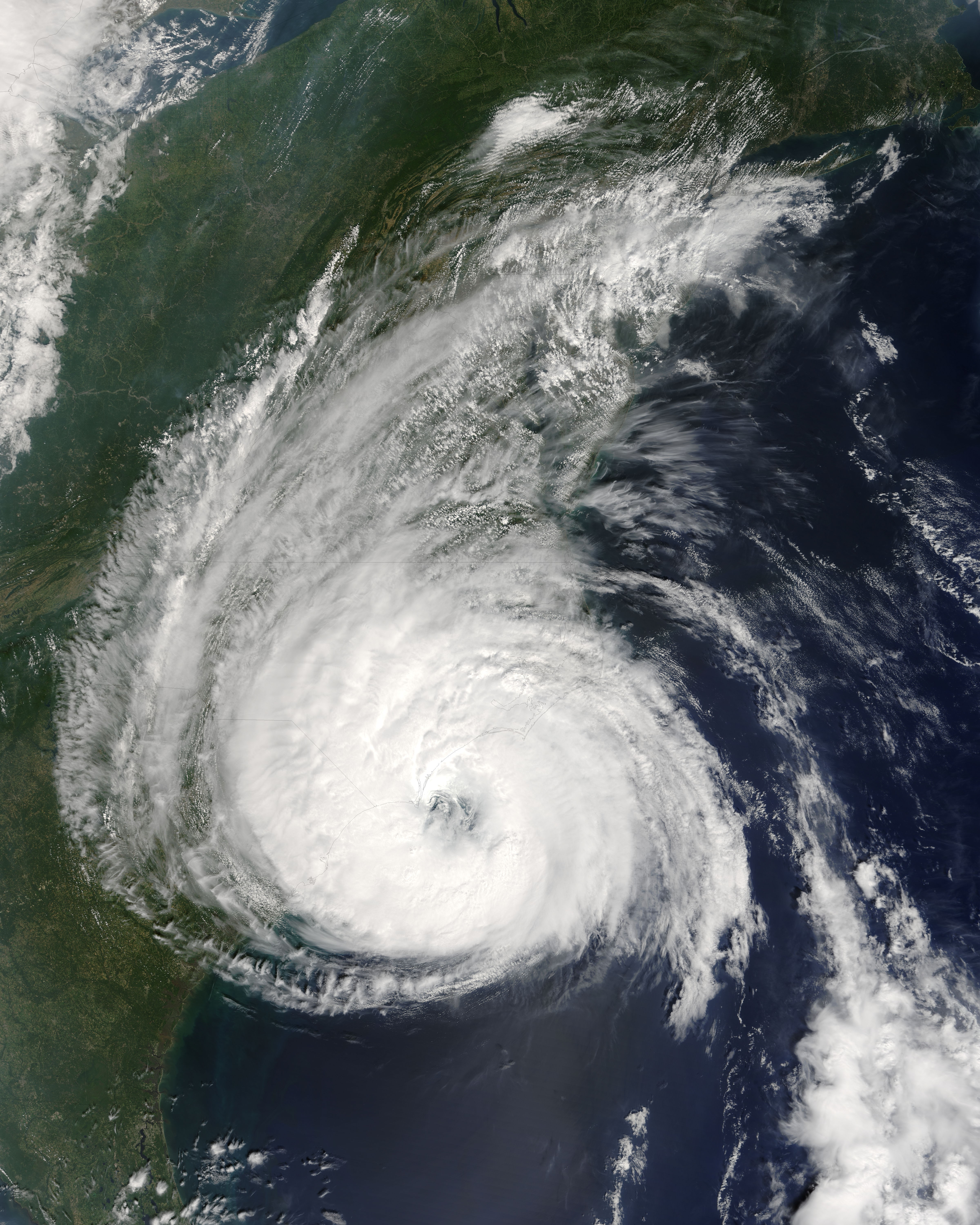
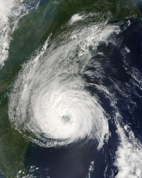
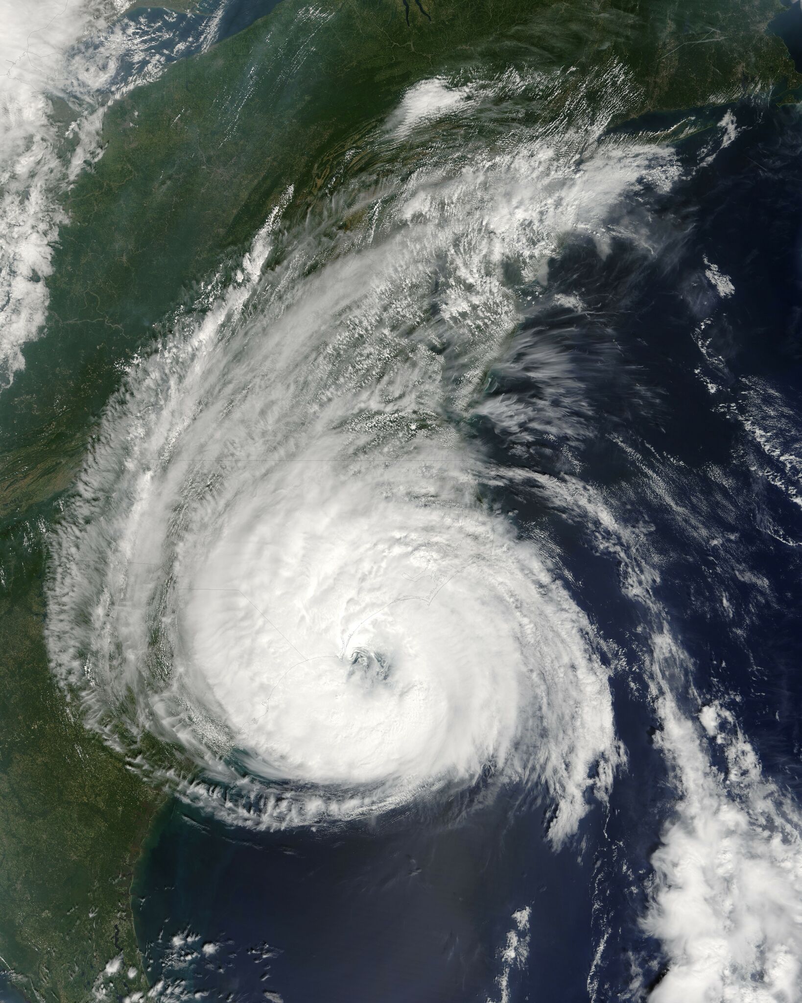
Hurricane Ophelia continued its wandering course along the U.S. Eastern Seaboard during the second week of September 2005. The storm was close to making landfall in North Carolina when the Moderate Resolution Imaging Spectroradiometer (MODIS) on NASA’s Terra satellite captured this image at 12:05 p.m. Eastern time on September 14, 2005. At the time, Ophelia had winds of 130 kilometers per hour (80 miles per hour) with substantially stronger gusts. The slow-moving storm was forecast to dump heavy rain on the Outer Banks of North Carolina before turning out to sea on its northeastward course. The large image provided above has a resolution of 250 meters per pixel. The image is available in additional resolutions from the MODIS Rapid Response Team. |
||
| Date | 2005-09-14 | ||
| Source | https://earthobservatory.nasa.gov/images/15513/hurricane-ophelia | ||
| Author | NASA image courtesy Jeff Schmaltz, MODIS Land Rapid Response Team at NASA GSFC | ||
| ⧼wm-license-information-permission⧽ (⧼wm-license-information-permission-reusing-text⧽) |
|
||
| ⧼wm-license-information-other-versions⧽ | Image:Hurricane Ophelia 9142005.jpg |
تاريخ الملف
اضغط على زمن/تاريخ لرؤية الملف كما بدا في هذا الزمن.
| زمن/تاريخ | صورة مصغرة | الأبعاد | مستخدم | تعليق | |
|---|---|---|---|---|---|
| حالي | ★ مراجعة معتمدة 11:40، 4 ديسمبر 2023 | | 4٬800 × 6٬000 (4٫86 ميجابايت) | Pastakhov (نقاش | مساهمات) | Upload https://upload.wikimedia.org/wikipedia/commons/f/fd/Ophelia_2005-09-14_1605Z_%28alternate%29.jpg |
لا يمكنك استبدال هذا الملف.
وصلات
لا يوجد صفحات تصل لهذه الصورة.
.jpg&oldid=3690424)