ملف:Mavericks wave diagram.gif
حجم هذه المعاينة: 467 × 600 بكسل. البعد الآخر: 2٬405 × 3٬089 بكسل.
الملف الأصلي (2٬405 × 3٬089 بكسل حجم الملف: 1٫77 ميجابايت، نوع MIME: image/gif)
وصف قصير
| Description |
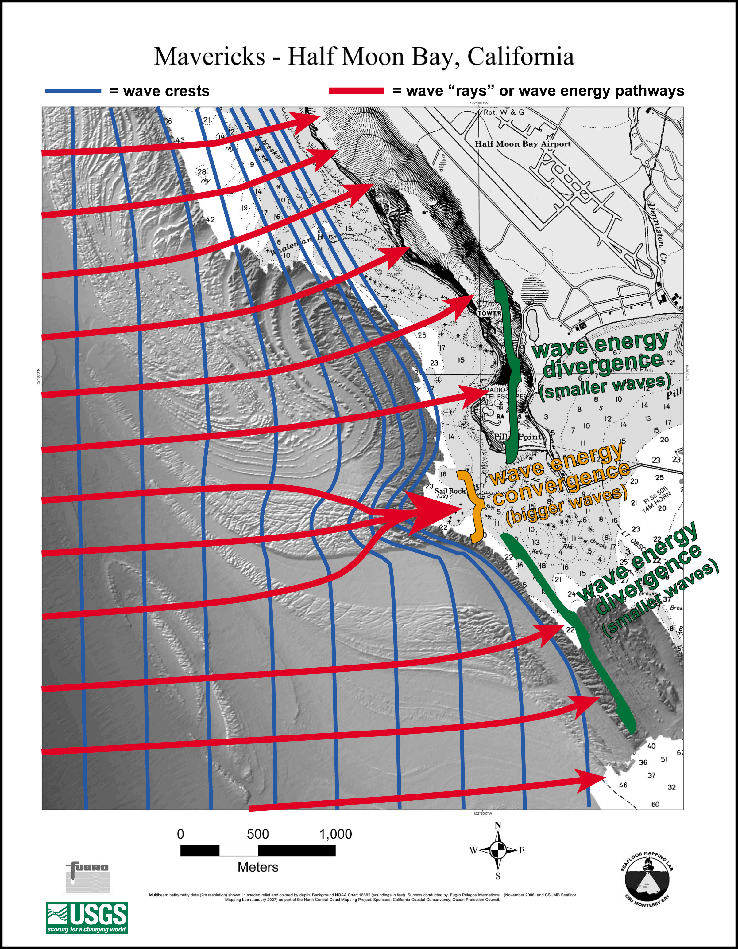
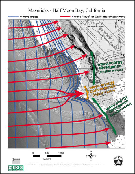
English: Diagram showing the effect of the bathymetry near the Mavericks surf break on the waves there. |
| Date | 2007 |
| Source | Diagram here, description here |
| Author | NOAA |
31°30′0″N 122°30′0″W / 31.50000°N 122.50000°W
ترخيص

|
تاريخ الملف
اضغط على زمن/تاريخ لرؤية الملف كما بدا في هذا الزمن.
| زمن/تاريخ | صورة مصغرة | الأبعاد | مستخدم | تعليق | |
|---|---|---|---|---|---|
| حالي | ★ مراجعة معتمدة 10:04، 26 ديسمبر 2023 | | 2٬405 × 3٬089 (1٫77 ميجابايت) | Pastakhov (نقاش | مساهمات) | Upload https://upload.wikimedia.org/wikipedia/commons/3/30/Mavericks_wave_diagram.gif |
لا يمكنك استبدال هذا الملف.
وصلات
لا يوجد صفحات تصل لهذه الصورة.