ملف:Mauritius Island topographic map-fr.jpg
حجم هذه المعاينة: 502 × 599 بكسل. البعد الآخر: 1٬810 × 2٬160 بكسل.
الملف الأصلي (1٬810 × 2٬160 بكسل حجم الملف: 942 كيلوبايت، نوع MIME: image/jpeg)
وصف قصير
20°15′00″S 57°35′00″E / 20.25000°S 57.58333°E
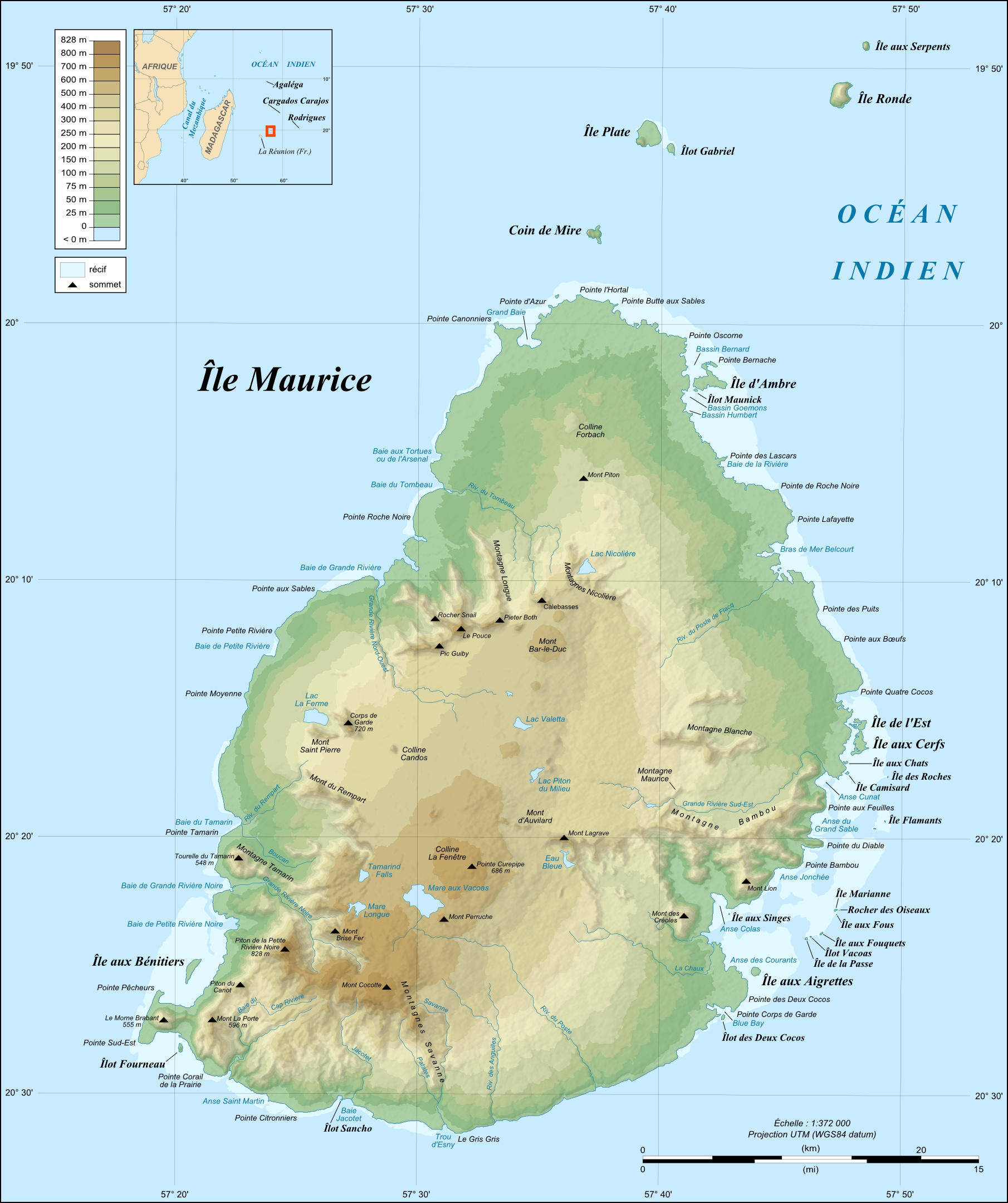
| Description |
English: Topographic map in French of Mauritius Island.
|
| Date | 2008-07 |
| Source |
Own work ;
|
| Author | Eric Gaba (Sting - fr:Sting) |
| ⧼wm-license-information-permission⧽ (⧼wm-license-information-permission-reusing-text⧽) |
مستخدم:Sting/Credits |
| ⧼wm-license-information-other-versions⧽ | قالب:Other versions/Mauritius Island map |
ترخيص
|

تاريخ الملف
اضغط على زمن/تاريخ لرؤية الملف كما بدا في هذا الزمن.
| زمن/تاريخ | صورة مصغرة | الأبعاد | مستخدم | تعليق | |
|---|---|---|---|---|---|
| حالي | ★ مراجعة معتمدة 11:45، 19 أكتوبر 2023 | | 1٬810 × 2٬160 (942 كيلوبايت) | Pastakhov (نقاش | مساهمات) | Upload https://upload.wikimedia.org/wikipedia/commons/8/89/Mauritius_Island_topographic_map-fr.jpg |
لا يمكنك استبدال هذا الملف.
وصلات
لا يوجد صفحات تصل لهذه الصورة.