ملف:Mariehamn map.svg

حجم معاينة PNG لذلك الملف ذي الامتداد SVG: 520 × 600 بكسل. البعد الآخر: 1٬775 × 2٬048 بكسل.
الملف الأصلي (ملف SVG، أبعاده 650 × 750 بكسل، حجم الملف: 277 كيلوبايت)
وصف قصير
| Description |
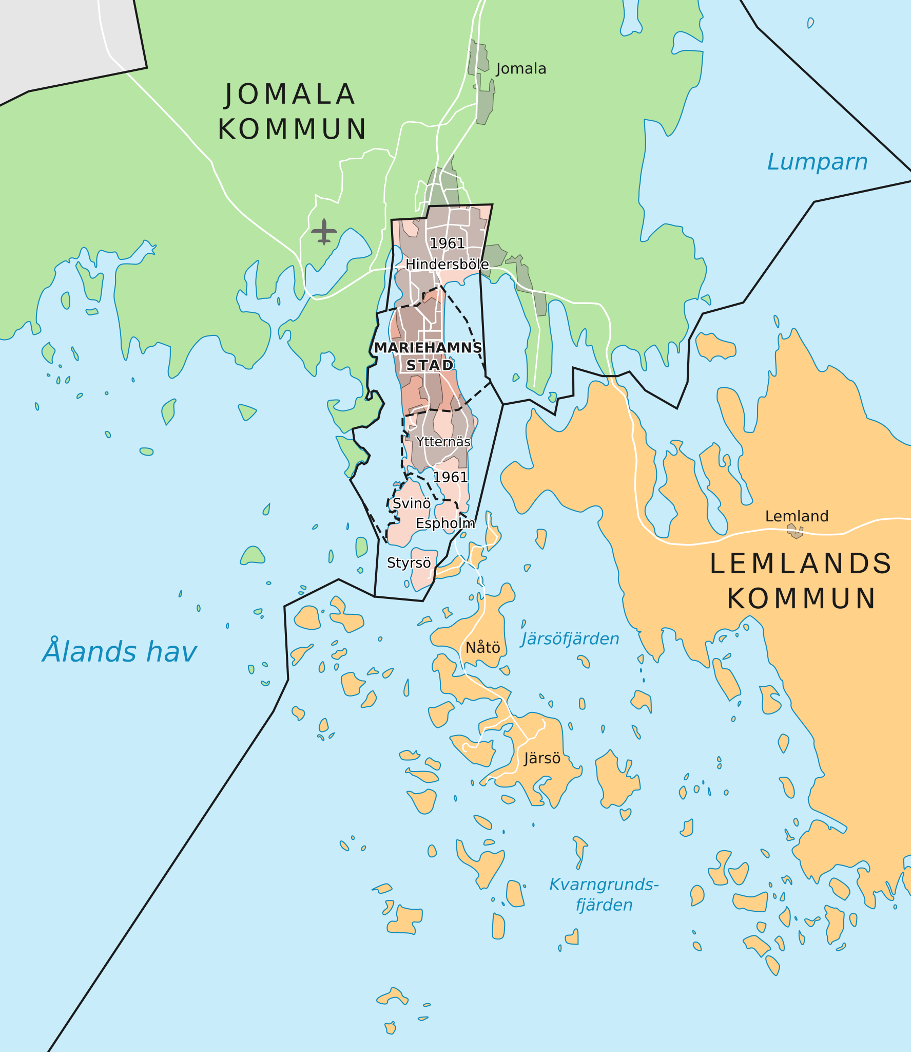
English: Map of Mariehamn, Åland, Finland, with the pre-1961 territory of the town marked with hatched outline.
(Finnish) |
| Date | 2021-04-25 |
| Source | Own work, data via [1], [2] and [3] |
| Author | Fenn-O-maniC |
ترخيص
|
تاريخ الملف
اضغط على زمن/تاريخ لرؤية الملف كما بدا في هذا الزمن.
| زمن/تاريخ | صورة مصغرة | الأبعاد | مستخدم | تعليق | |
|---|---|---|---|---|---|
| حالي | ★ مراجعة معتمدة 21:07، 6 أكتوبر 2023 | | 650 × 750 (277 كيلوبايت) | Pastakhov (نقاش | مساهمات) | Upload https://upload.wikimedia.org/wikipedia/commons/4/4f/Mariehamn_map.svg |
لا يمكنك استبدال هذا الملف.
وصلات
لا يوجد صفحات تصل لهذه الصورة.