ملف:Map of Westarctica.jpg
حجم هذه المعاينة: 679 × 600 بكسل. البعد الآخر: 1٬334 × 1٬178 بكسل.
الملف الأصلي (1٬334 × 1٬178 بكسل حجم الملف: 377 كيلوبايت، نوع MIME: image/jpeg)
وصف قصير
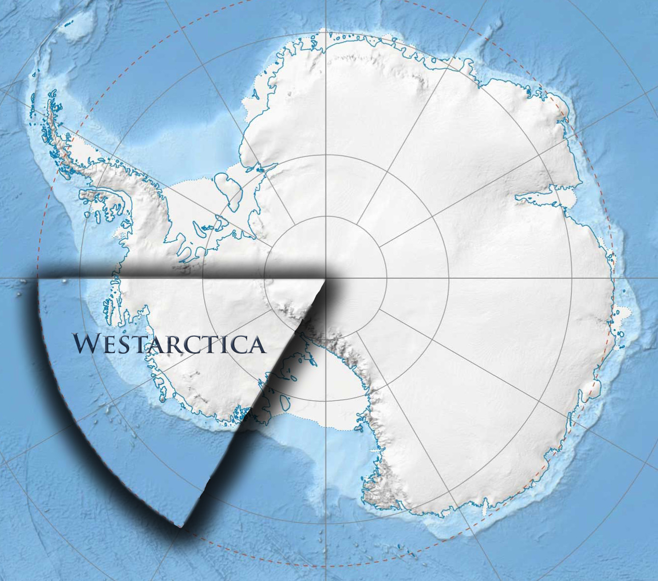
| Description |
English: This is a map showing the claimed area of the micronation Westarctica. This is the area that was originally claimed in 2001 as evidenced in the claimant letter which was sent to nine world governments and the United Nations Office of Polar Affairs. Although the claim is not generally viewed as legitimate, it has never been challenged. |
| Date | 2012-10-07 17:44:30 |
| Source | Own work |
| Author | Travis McHenry |
ترخيص
|
تاريخ الملف
اضغط على زمن/تاريخ لرؤية الملف كما بدا في هذا الزمن.
| زمن/تاريخ | صورة مصغرة | الأبعاد | مستخدم | تعليق | |
|---|---|---|---|---|---|
| حالي | ★ مراجعة معتمدة 13:33، 23 أكتوبر 2023 | | 1٬334 × 1٬178 (377 كيلوبايت) | Pastakhov (نقاش | مساهمات) | Upload https://upload.wikimedia.org/wikipedia/commons/b/b6/Map_of_Westarctica.jpg |
لا يمكنك استبدال هذا الملف.
وصلات
لا يوجد صفحات تصل لهذه الصورة.