ملف:Map of Cuyahoga County Ohio With Municipal and Township Labels.PNG
حجم هذه المعاينة: 331 × 600 بكسل. البعد الآخر: 710 × 1٬287 بكسل.
الملف الأصلي (710 × 1٬287 بكسل حجم الملف: 90 كيلوبايت، نوع MIME: image/png)
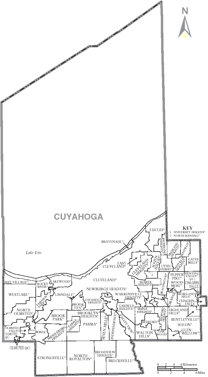
| Description | Map of Cuyahoga County, Ohio, United States with township and municipal boundaries |
| Date | 2006-07 |
| Source | taken from US Census website [1] and modified by User:Ruhrfisch |
| Author | US Census, Ruhrfisch |
| ⧼wm-license-information-permission⧽ (⧼wm-license-information-permission-reusing-text⧽) |
US Census / US Government work is public domain, my modifications licensed under the GNU Free Documentation License |

|
تاريخ الملف
اضغط على زمن/تاريخ لرؤية الملف كما بدا في هذا الزمن.
| زمن/تاريخ | صورة مصغرة | الأبعاد | مستخدم | تعليق | |
|---|---|---|---|---|---|
| حالي | ★ مراجعة معتمدة 21:18، 25 يناير 2025 | | 710 × 1٬287 (90 كيلوبايت) | Pastakhov (نقاش | مساهمات) | Upload https://upload.wikimedia.org/wikipedia/commons/5/53/Map_of_Cuyahoga_County_Ohio_With_Municipal_and_Township_Labels.PNG |
لا يمكنك استبدال هذا الملف.
وصلات
لا يوجد صفحات تصل لهذه الصورة.