ملف:Lloyd Street, Islington - geograph.org.uk - 1706457.jpg
حجم هذه المعاينة: 800 × 600 بكسل. البعد الآخر: 1٬280 × 960 بكسل.
الملف الأصلي (1٬280 × 960 بكسل حجم الملف: 341 كيلوبايت، نوع MIME: image/jpeg)
وصف قصير
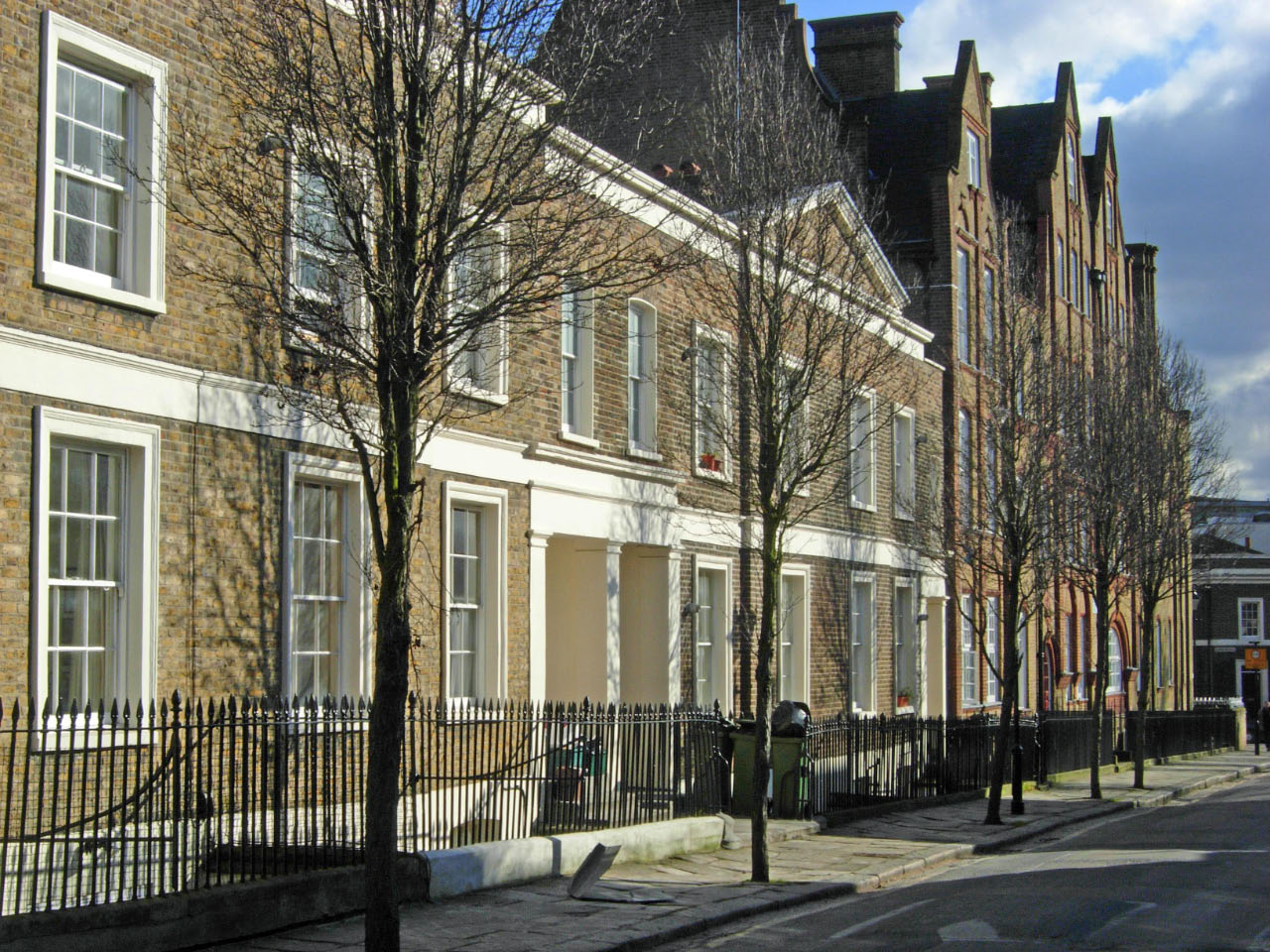
| Description |
English: Lloyd Street, Islington Named after the Lloyd Baker family, who owned the estate at the time it was developed for housing in the 1820s, Lloyd Street connects Great Percy Street with Lloyd Square. The houses in the foreground are original but beyond them is Bethany House built in 1881. |
| Date | 2010-02-11 |
| Source | From geograph.org.uk |
| Author | Stephen McKay |
| ⧼wm-license-cc-attribution⧽ (قالب:I18n/Credit line) |
Stephen McKay / Lloyd Street, Islington / |
51°31′46″N 0°06′41″W / 51.52939°N 0.1114°W
_heading:135)
| Object location | ملف:Compass-icon bb SE.svg | View all coordinates using: OpenStreetMap |
|---|
_heading:135.00&language=⧼lang⧽)
ترخيص
تاريخ الملف
اضغط على زمن/تاريخ لرؤية الملف كما بدا في هذا الزمن.
| زمن/تاريخ | صورة مصغرة | الأبعاد | مستخدم | تعليق | |
|---|---|---|---|---|---|
| حالي | ★ مراجعة معتمدة 14:39، 10 نوفمبر 2023 | | 1٬280 × 960 (341 كيلوبايت) | Pastakhov (نقاش | مساهمات) | Upload https://upload.wikimedia.org/wikipedia/commons/7/70/Lloyd_Street%2C_Islington_-_geograph.org.uk_-_1706457.jpg |
لا يمكنك استبدال هذا الملف.
وصلات
لا يوجد صفحات تصل لهذه الصورة.