ملف:Leeds UK location map.svg

حجم معاينة PNG لذلك الملف ذي الامتداد SVG: 697 × 599 بكسل. البعد الآخر: 2٬382 × 2٬048 بكسل.
الملف الأصلي (ملف SVG، أبعاده 785 × 675 بكسل، حجم الملف: 1٫81 ميجابايت)
وصف قصير
| Description |
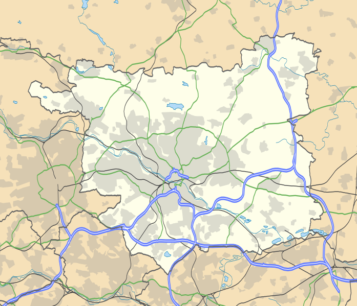
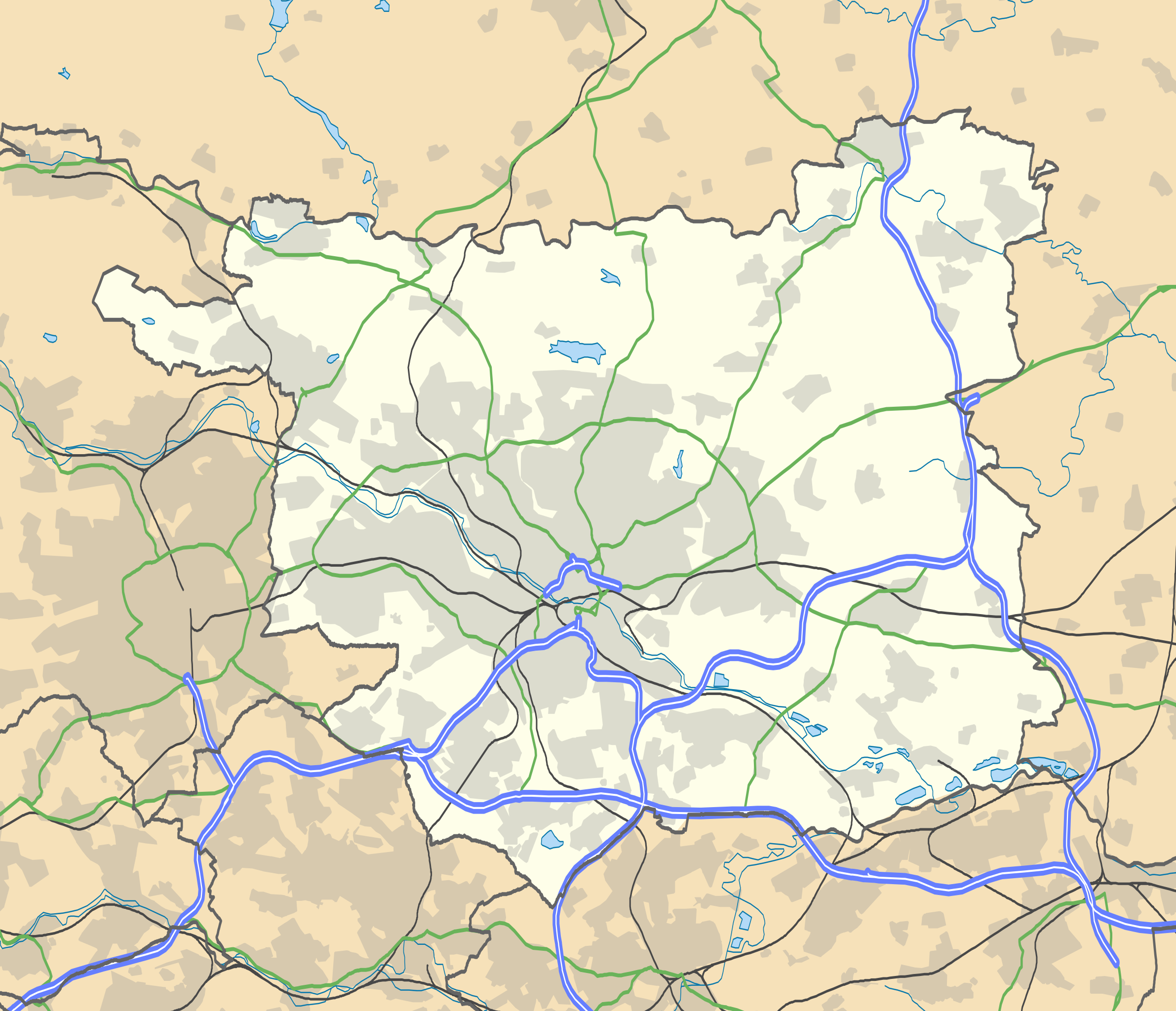
Map of West Yorkshire, UK with the following information shown:
|
||
| Date | 2010-09-26 | ||
| Source |
|
||
| Author | Rcsprinter123 using a work by Nilfanion, created using Ordnance Survey data | ||
| ⧼wm-license-information-permission⧽ (⧼wm-license-information-permission-reusing-text⧽) |
|
||
| ⧼wm-license-information-other-versions⧽ | File:West Yorkshire UK location map.svg - Full map |
تاريخ الملف
اضغط على زمن/تاريخ لرؤية الملف كما بدا في هذا الزمن.
| زمن/تاريخ | صورة مصغرة | الأبعاد | مستخدم | تعليق | |
|---|---|---|---|---|---|
| حالي | ★ مراجعة معتمدة 09:38، 10 نوفمبر 2023 | | 785 × 675 (1٫81 ميجابايت) | Pastakhov (نقاش | مساهمات) | Upload https://upload.wikimedia.org/wikipedia/commons/3/30/Leeds_UK_location_map.svg |
لا يمكنك استبدال هذا الملف.
وصلات
لا يوجد صفحات تصل لهذه الصورة.