ملف:Laysan map lrg.gif
لا توجد دقة أعلى متوفرة.
Laysan_map_lrg.gif (600 × 546 بكسل حجم الملف: 17 كيلوبايت، نوع MIME: image/gif)
وصف قصير
| Description |
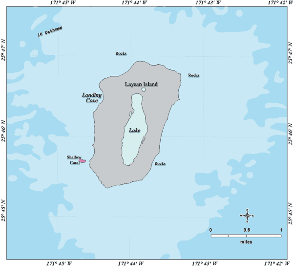
Deutsch: Bathymetrische Karte der Insel Laysan, Nordwestliche Hawaii-Inseln
English: Bathymetric map of Laysan Island, Northwestern Hawaiian Islands |
| Date | not specified |
| Source | http://www.hawaiireef.noaa.gov/imagery/graphicmaps.html |
| Author | Christine Taylor, NOAA's National Marine Sanctuary Program |
| ⧼wm-license-information-permission⧽ (⧼wm-license-information-permission-reusing-text⧽) |
credit to NOAA is preferred |
ترخيص
قالب:Original upload log
16:32, 22 April 2006 SeanMD80 (Talk | contribs) (Bathymetric map of Laysan Island. {PD-USGov-DOC-NOAA})
تاريخ الملف
اضغط على زمن/تاريخ لرؤية الملف كما بدا في هذا الزمن.
| زمن/تاريخ | صورة مصغرة | الأبعاد | مستخدم | تعليق | |
|---|---|---|---|---|---|
| حالي | ★ مراجعة معتمدة 17:44، 6 أكتوبر 2023 | | 600 × 546 (17 كيلوبايت) | Pastakhov (نقاش | مساهمات) | Upload https://upload.wikimedia.org/wikipedia/commons/e/e0/Laysan_map_lrg.gif |
لا يمكنك استبدال هذا الملف.
وصلات
لا يوجد صفحات تصل لهذه الصورة.