ملف:Lake Winnipeg map FR.png

حجم هذه المعاينة: 575 × 600 بكسل. البعد الآخر: 1٬000 × 1٬043 بكسل.
الملف الأصلي (1٬000 × 1٬043 بكسل حجم الملف: 215 كيلوبايت، نوع MIME: image/png)
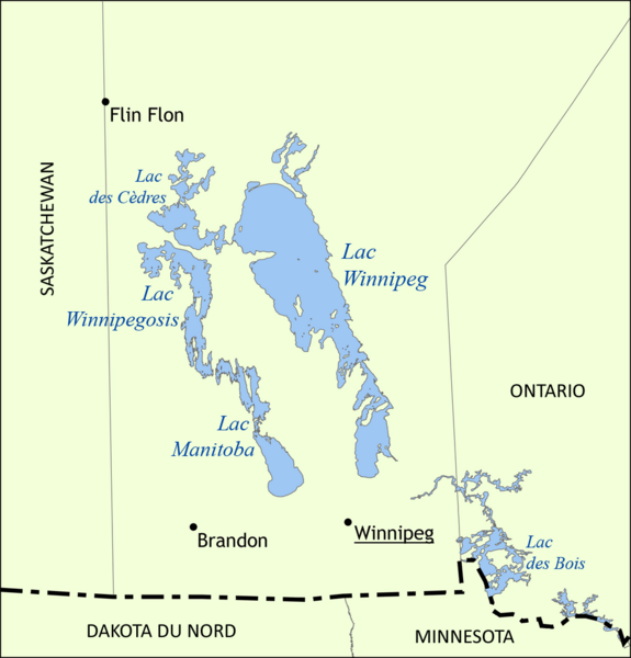
| Description | Carte des lacs du Manitoba. |
| Date | 2010-07-29 13:57 (UTC) |
| Source | |
| Author |
|
| [This is a retouched picture, which means that it has been digitally altered from its original version. Modifications: Translated into French. The original can be viewed here: Lake_Winnipeg_map.png.] Error: {{Lang}}: text has italic markup (help)
|
|

قالب:Original upload log
This image is a derivative work of the following images:
- File:Lake_Winnipeg_map.png licensed with Cc-by-sa-3.0, GFDL
- 2006-05-31T15:41:08Z NormanEinstein 1000x1043 (94198 Bytes) Map showing the location of Lake Winnipeg, Lake Manitoba, and Lake Winnipegosis in Manitoba, Canada. Created by NormanEinstein, May 31, 2006. {{GFDL-self}} [[Category:Maps of Manitoba]]
تاريخ الملف
اضغط على زمن/تاريخ لرؤية الملف كما بدا في هذا الزمن.
| زمن/تاريخ | صورة مصغرة | الأبعاد | مستخدم | تعليق | |
|---|---|---|---|---|---|
| حالي | ★ مراجعة معتمدة 23:45، 30 أكتوبر 2023 | | 1٬000 × 1٬043 (215 كيلوبايت) | Pastakhov (نقاش | مساهمات) | Upload https://upload.wikimedia.org/wikipedia/commons/a/a9/Lake_Winnipeg_map_FR.png |
لا يمكنك استبدال هذا الملف.
وصلات
لا يوجد صفحات تصل لهذه الصورة.