ملف:Kherlenrivermap.png
حجم هذه المعاينة: 667 × 600 بكسل. البعد الآخر: 1٬000 × 899 بكسل.
الملف الأصلي (1٬000 × 899 بكسل حجم الملف: 249 كيلوبايت، نوع MIME: image/png)
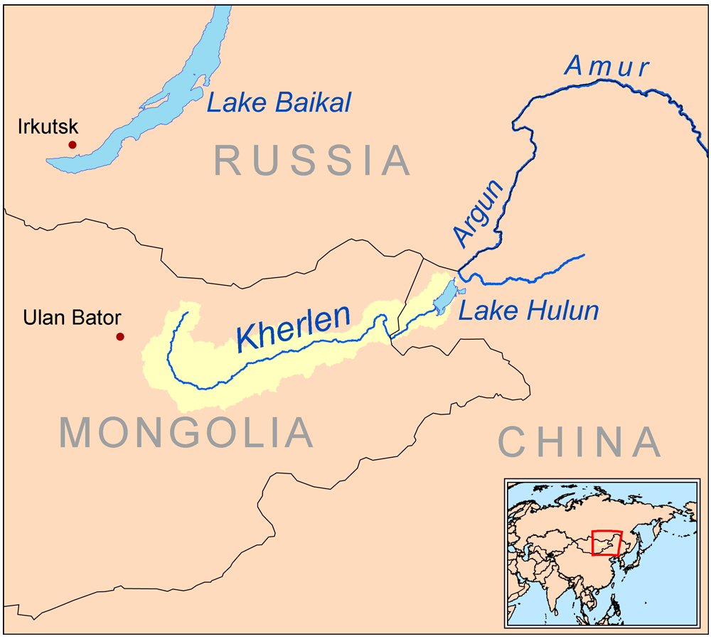
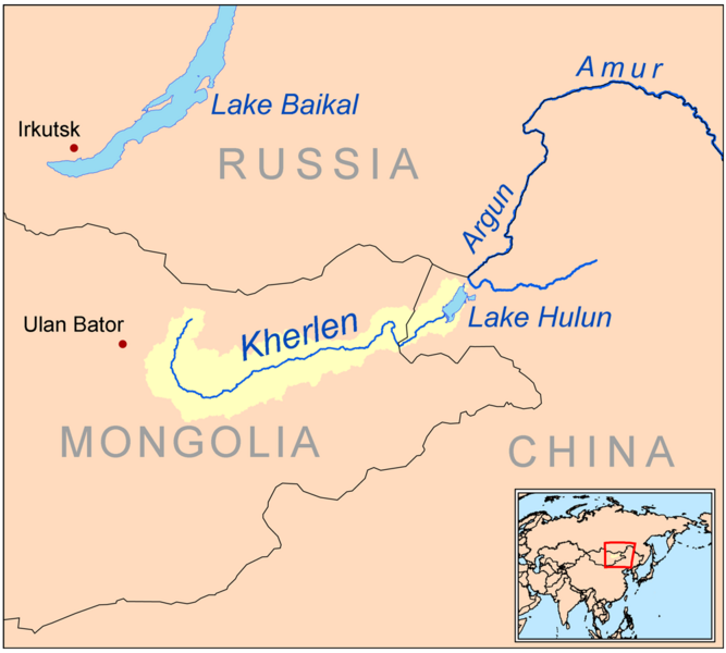
| Description | This is a map of the Kherlen River drainage basin. |
| Date | 2009-04-09 |
| Source | Own work using Digital Chart of the World and GTOPO data. |
| Author | Kmusser |
|
تاريخ الملف
اضغط على زمن/تاريخ لرؤية الملف كما بدا في هذا الزمن.
| زمن/تاريخ | صورة مصغرة | الأبعاد | مستخدم | تعليق | |
|---|---|---|---|---|---|
| حالي | ★ مراجعة معتمدة 15:26، 21 أكتوبر 2023 | | 1٬000 × 899 (249 كيلوبايت) | Pastakhov (نقاش | مساهمات) | Upload https://upload.wikimedia.org/wikipedia/commons/2/2b/Kherlenrivermap.png |
لا يمكنك استبدال هذا الملف.
وصلات
لا يوجد صفحات تصل لهذه الصورة.