ملف:Karte Mount Everest.png
حجم هذه المعاينة: 600 × 600 بكسل. البعد الآخر: 1٬000 × 1٬000 بكسل.
الملف الأصلي (1٬000 × 1٬000 بكسل حجم الملف: 1٫1 ميجابايت، نوع MIME: image/png)
| Description |
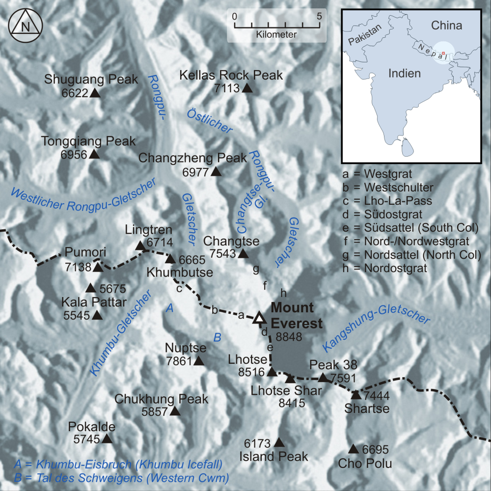
Deutsch: Karte der Region um den Mount Everest English: Map of the region surrounding Mount Everest |
| Date | 2008-01 |
| Source |
own work, used:
|
| Author | Lencer |
|
|
هذا الملفُّ مُرخَّص بموجب رخصة المشاع الإبداعي نسبة المُصنَّف إِلى مؤلفه - المشاركة بالمثل 3.0 العامة. |

|
[All images in this gallery should be recreated using vector graphics as an SVG file. This has several advantages; see Commons:Media for cleanup for more information. If an SVG form of this image is already available, please upload it. After uploading an SVG, replace this template with {{vector version available|new image name.svg}}.] Error: {{Lang}}: text has italic markup (help) |
|
العربية | български | català | čeština | dansk | Deutsch | English | Esperanto | español | français | galego | 한국어 | italiano | magyar | lietuvių | 日本語 | Plattdüütsch | Nederlands | norsk | polski | português | română | русский | suomi | svenska | Türkçe | українська | 中文(繁體) | 中文(简体) | +/− | |
تاريخ الملف
اضغط على زمن/تاريخ لرؤية الملف كما بدا في هذا الزمن.
| زمن/تاريخ | صورة مصغرة | الأبعاد | مستخدم | تعليق | |
|---|---|---|---|---|---|
| حالي | ★ مراجعة معتمدة 17:47، 25 أكتوبر 2023 | | 1٬000 × 1٬000 (1٫1 ميجابايت) | Pastakhov (نقاش | مساهمات) | Upload https://upload.wikimedia.org/wikipedia/commons/c/cc/Karte_Mount_Everest.png |
لا يمكنك استبدال هذا الملف.
وصلات
لا يوجد صفحات تصل لهذه الصورة.