ملف:Kaloum Peninsula 2000.jpg
حجم هذه المعاينة: 800 × 600 بكسل. البعد الآخر: 2٬000 × 1٬500 بكسل.
الملف الأصلي (2٬000 × 1٬500 بكسل حجم الملف: 4٫47 ميجابايت، نوع MIME: image/jpeg)
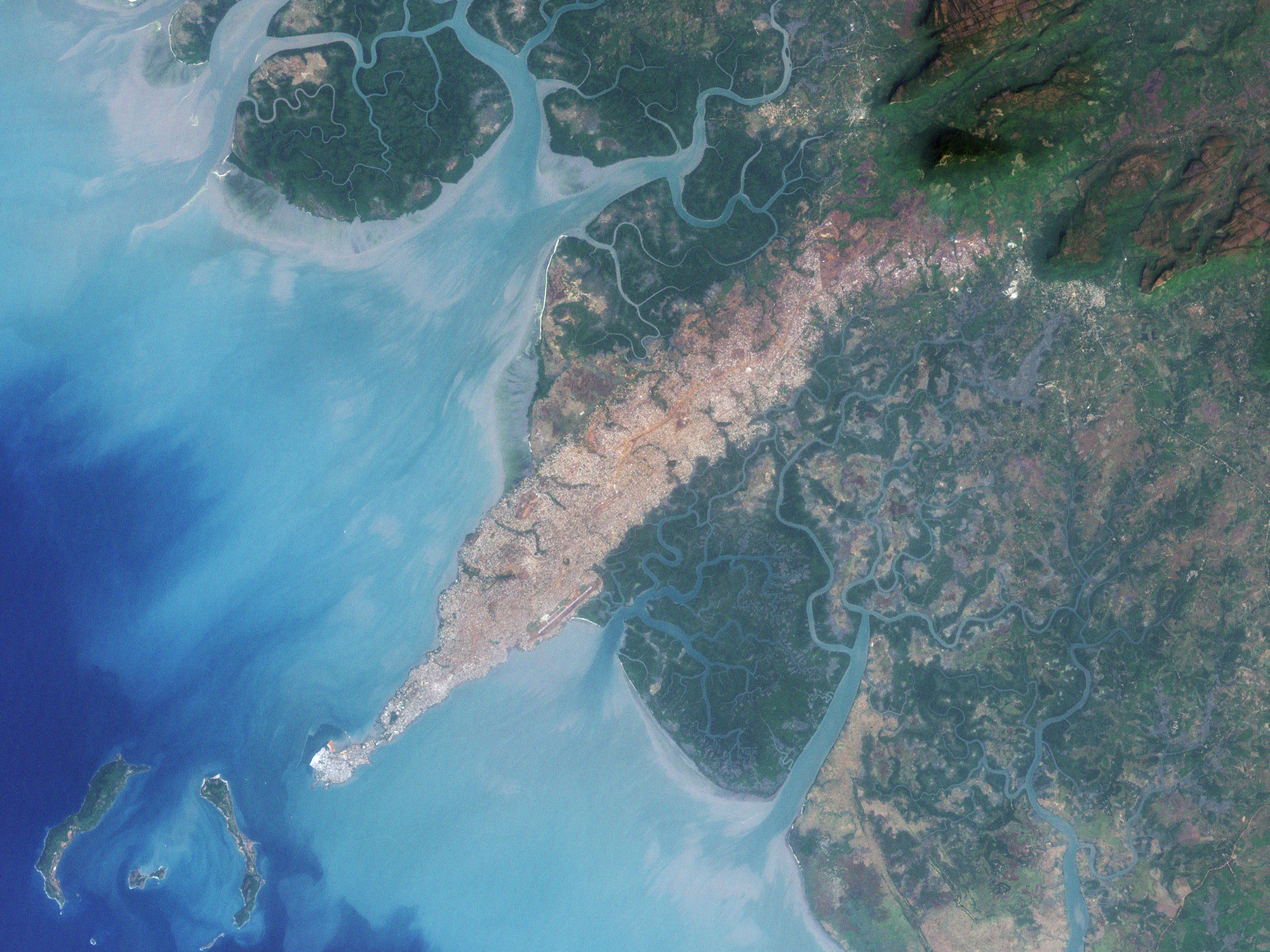
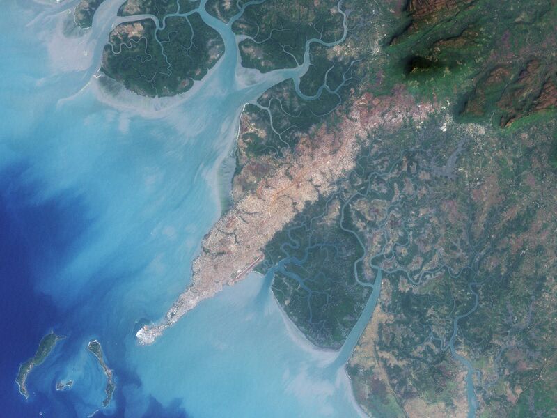
| Description | The city of Conakry, Guinea, originated on Tombo Island and spread up the Kaloum Peninsula, sandwiched between mangrove swamps. In the 1960s, the city had a population of fewer than 40,000; in 2006, it had a population of nearly 2 million. These natural-color images, acquired by NASA’s Landsat satellites, show the city’s dramatic growth from 1986 to 2000. Land and water features look similar to how they would look in a photograph by a digital camera. Water ranges in color from deep to pale blue, vegetation appears dark green, and bare ground and urbanized areas range in color from gray to beige to reddish-brown. | ||
| Date | 2000-12-19 | ||
| Source | Earth Observatory | ||
| Author | NASA image created by Jesse Allen, using Landsat data provided by the United States Geological Survey. Landsat 7 | ||
| ⧼wm-license-information-permission⧽ (⧼wm-license-information-permission-reusing-text⧽) |
|
||
| ⧼wm-license-information-other-versions⧽ |
ملف:Kaloum Peninsula 1986.jpg January 3, 1986 |
تاريخ الملف
اضغط على زمن/تاريخ لرؤية الملف كما بدا في هذا الزمن.
| زمن/تاريخ | صورة مصغرة | الأبعاد | مستخدم | تعليق | |
|---|---|---|---|---|---|
| حالي | ★ مراجعة معتمدة 23:49، 1 ديسمبر 2023 | | 2٬000 × 1٬500 (4٫47 ميجابايت) | Pastakhov (نقاش | مساهمات) | Upload https://upload.wikimedia.org/wikipedia/commons/3/3a/Kaloum_Peninsula_2000.jpg |
لا يمكنك استبدال هذا الملف.
وصلات
لا يوجد صفحات تصل لهذه الصورة.