ملف:Japan-Archipelago-Outlined-Islands-Map.png

حجم هذه المعاينة: 734 × 600 بكسل. البعد الآخر: 2٬012 × 1٬644 بكسل.
الملف الأصلي (2٬012 × 1٬644 بكسل حجم الملف: 3٫2 ميجابايت، نوع MIME: image/png)
وصف قصير
| Description |
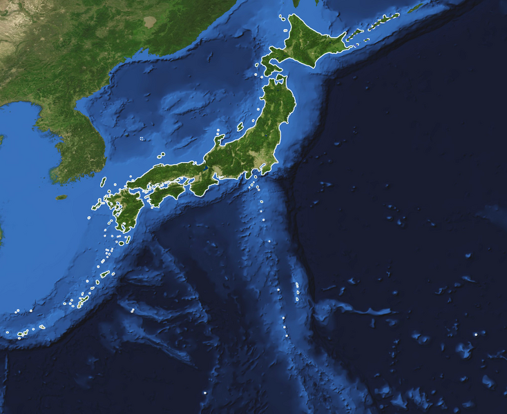
English: This is a topography and bathymetry map of the Japanese archipelago with outlined islands. It shows the land and the seabed of Japan. All significant Japanese owned and controlled islands are outlined with a solid line such as Minami-Tori-Shima, Okinotorishima, Yonaguni and the Senkaku islands. The northern territories (kuril islands) and Takeshima have a dashed line.
(Japanese) |
| Date | 2004-07-01 |
| Source | Blue Marble Next Generation W/ Topography and Bathymetry (July 1 - 31, 2004) https://visibleearth.nasa.gov/view.php?id=73751 |
| Author | Credit: Reto Stöckli, NASA Earth Observatory |
ترخيص
تاريخ الملف
اضغط على زمن/تاريخ لرؤية الملف كما بدا في هذا الزمن.
| زمن/تاريخ | صورة مصغرة | الأبعاد | مستخدم | تعليق | |
|---|---|---|---|---|---|
| حالي | ★ مراجعة معتمدة 18:03، 19 يناير 2024 | | 2٬012 × 1٬644 (3٫2 ميجابايت) | Pastakhov (نقاش | مساهمات) | Upload https://upload.wikimedia.org/wikipedia/commons/6/6b/Japan-Archipelago-Outlined-Islands-Map.png |
لا يمكنك استبدال هذا الملف.
وصلات
لا يوجد صفحات تصل لهذه الصورة.