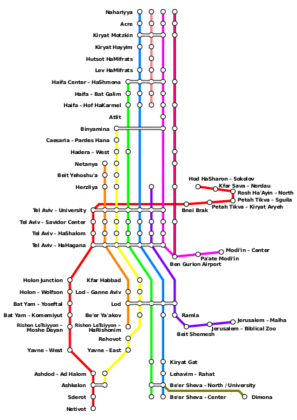
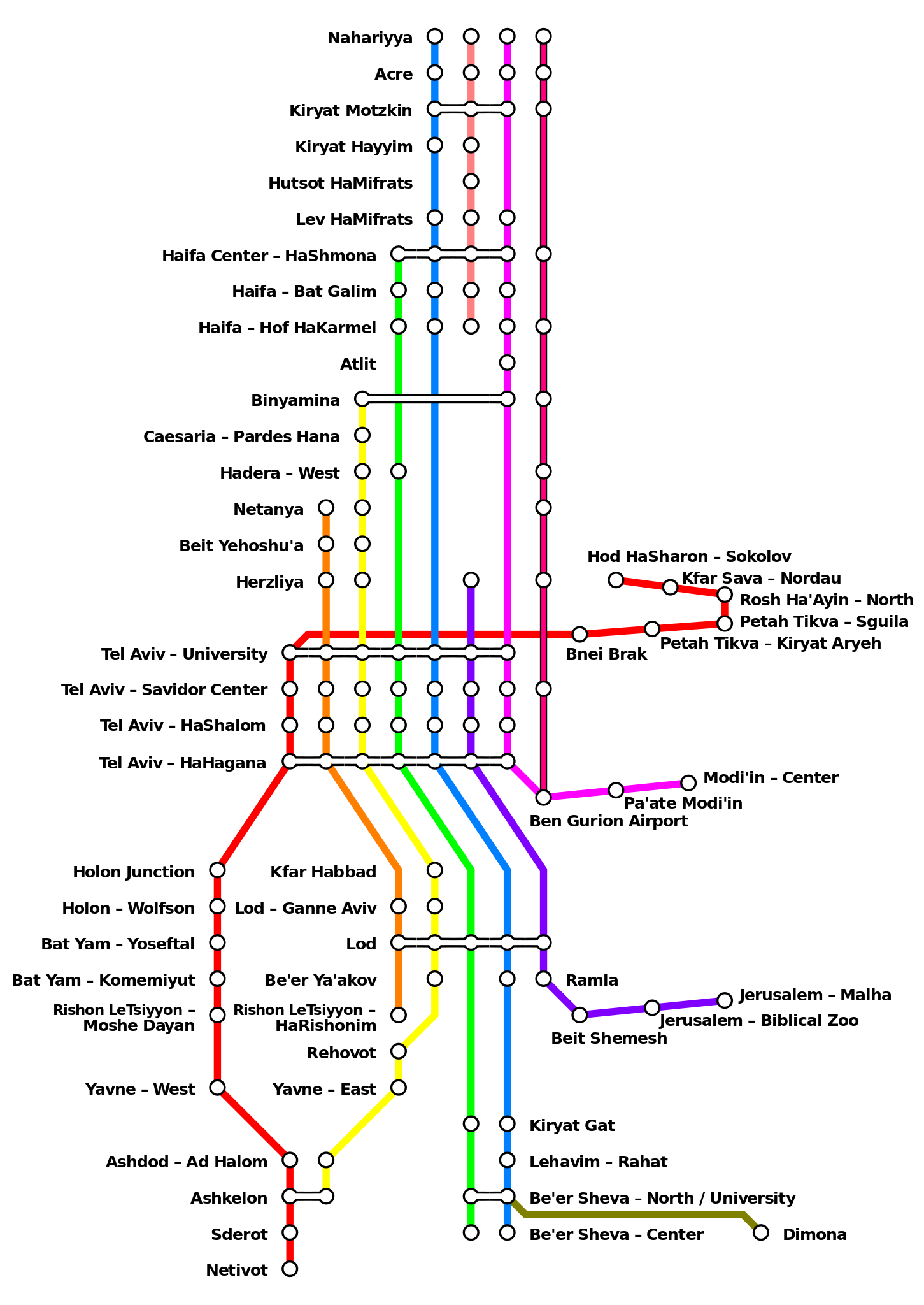
ملف:Israel Railways map 2015.svg

حجم معاينة PNG لذلك الملف ذي الامتداد SVG: 425 × 600 بكسل. البعد الآخر: 1٬451 × 2٬048 بكسل.
الملف الأصلي (ملف SVG، أبعاده 1٬275 × 1٬800 بكسل، حجم الملف: 36 كيلوبايت)
وصف قصير
| Description |
English: Israel Railways map as of April 2015 |
| Date | 2015-04-16 |
| Source |
File:Ir2011map2.png |
| Author |
File:Ir2011map2.png: User:Atefrat |
| ⧼wm-license-information-other-versions⧽ | قالب:Derived from |
Redrawn from IR source, with graphical liberties taken to avoid rotated text.
ترخيص
|
تاريخ الملف
اضغط على زمن/تاريخ لرؤية الملف كما بدا في هذا الزمن.
| زمن/تاريخ | صورة مصغرة | الأبعاد | مستخدم | تعليق | |
|---|---|---|---|---|---|
| حالي | ★ مراجعة معتمدة 05:24، 28 أكتوبر 2023 | | 1٬275 × 1٬800 (36 كيلوبايت) | Pastakhov (نقاش | مساهمات) | Upload https://upload.wikimedia.org/wikipedia/commons/1/16/Israel_Railways_map_2015.svg |
لا يمكنك استبدال هذا الملف.
وصلات
لا يوجد صفحات تصل لهذه الصورة.