ملف:Franco-Cantabrian region.gif
حجم هذه المعاينة: 800 × 403 بكسل. البعد الآخر: 956 × 482 بكسل.
الملف الأصلي (956 × 482 بكسل حجم الملف: 21 كيلوبايت، نوع MIME: image/gif)
وصف قصير
| Description |
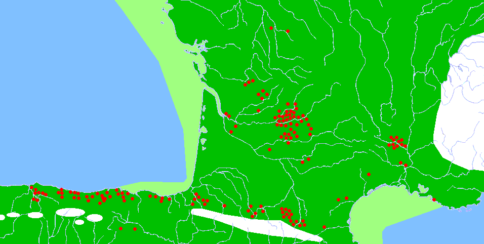
Description: Map of the Franco-Cantabrian archaeological region (Upper Paleolithic), showing:
|
| Date | 2006-12-31 |
| Source |
|
| Author |
|
| ⧼wm-license-information-permission⧽ (⧼wm-license-information-permission-reusing-text⧽) |
Released into the public domain (by the author). |
| ⧼wm-license-information-other-versions⧽ | قالب:DerivativeVersions |
ترخيص
| [ This image has been (or is hereby) released into the public domain by its author, Sugaar at the wikipedia project. This applies worldwide. In case this is not legally possible: Deutsch · Ελληνικά · English · Plattdüütsch · 中文(简体) · 中文(繁體) · +/− |
تاريخ الملف
اضغط على زمن/تاريخ لرؤية الملف كما بدا في هذا الزمن.
| زمن/تاريخ | صورة مصغرة | الأبعاد | مستخدم | تعليق | |
|---|---|---|---|---|---|
| حالي | ★ مراجعة معتمدة 19:46، 14 أكتوبر 2023 | | 956 × 482 (21 كيلوبايت) | Pastakhov (نقاش | مساهمات) | Upload https://upload.wikimedia.org/wikipedia/commons/6/64/Franco-Cantabrian_region.gif |
لا يمكنك استبدال هذا الملف.
وصلات
لا يوجد صفحات تصل لهذه الصورة.