ملف:France1911dev.png
حجم هذه المعاينة: 441 × 599 بكسل. البعد الآخر: 2٬046 × 2٬780 بكسل.
الملف الأصلي (2٬046 × 2٬780 بكسل حجم الملف: 3٫94 ميجابايت، نوع MIME: image/png)
وصف قصير
| Description |
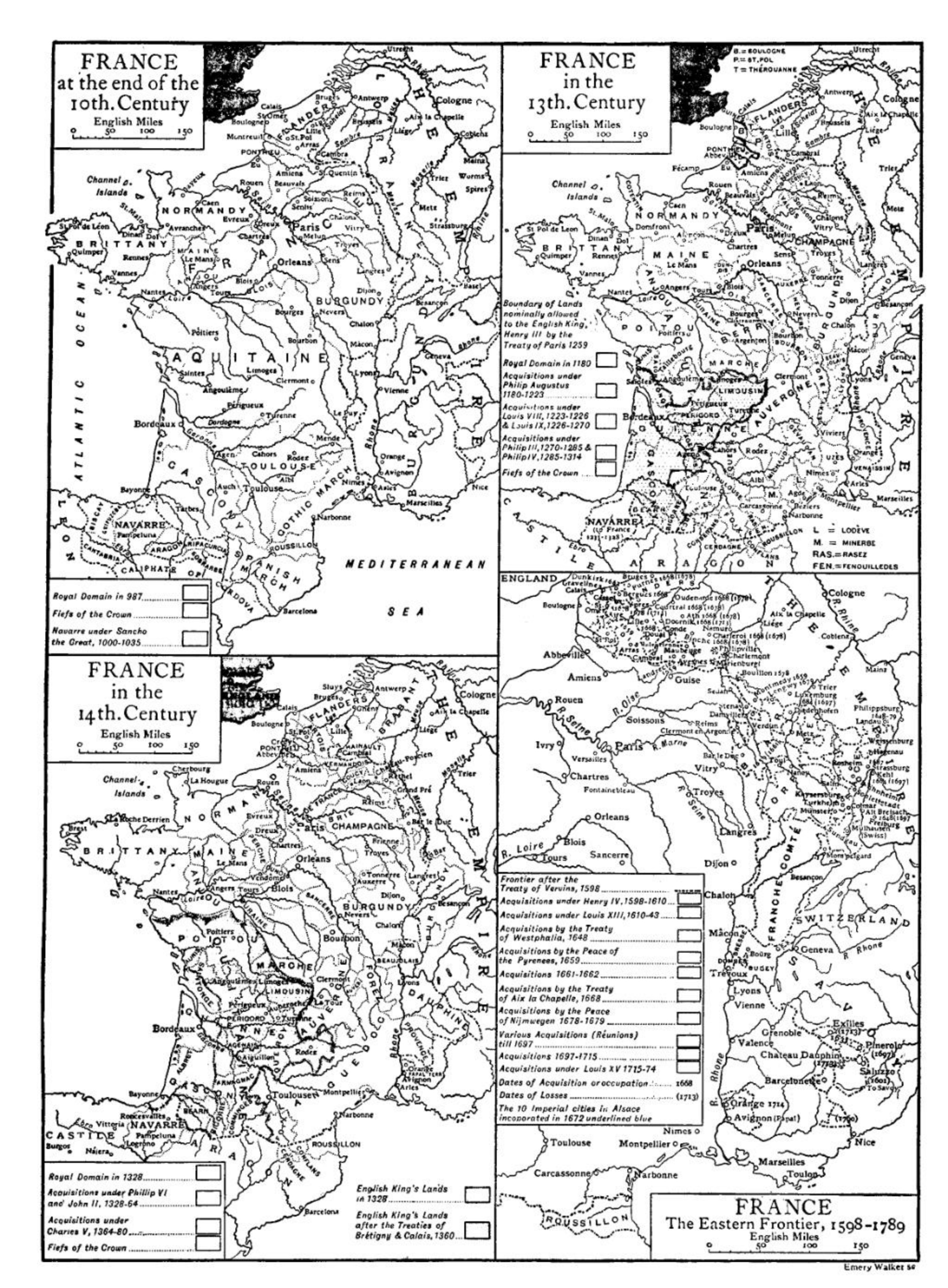
Four inset maps of the historical development of France:
|
| Date | before 1911 |
| Source | "France" in the Encyclopædia Britannica, 11th ed. 1911. |
| Author | Credited to Emery Walker |
ترخيص
تاريخ الملف
اضغط على زمن/تاريخ لرؤية الملف كما بدا في هذا الزمن.
| زمن/تاريخ | صورة مصغرة | الأبعاد | مستخدم | تعليق | |
|---|---|---|---|---|---|
| حالي | ★ مراجعة معتمدة 20:03، 23 أكتوبر 2023 | | 2٬046 × 2٬780 (3٫94 ميجابايت) | Pastakhov (نقاش | مساهمات) | Upload https://upload.wikimedia.org/wikipedia/commons/2/23/France1911dev.png |
لا يمكنك استبدال هذا الملف.
وصلات
لا يوجد صفحات تصل لهذه الصورة.
تصنيفات:
- Old maps of France
- Maps of 10th-century France
- Maps of 13th-century France
- Maps of 14th-century France
- Maps of 16th-century France
- France in the 17th century
- Maps of 18th-century France
- France in the 980s
- France in the 1180s
- France in the 1220s
- France in the 1270s
- France in the 1310s
- Maps of 14th-century England
- England in the 1250s
- England in the 1320s
- England in the 1360s
- France in the 1320s
- France in the 1360s
- France in the 1380s
- France in the 1590s
- France in the 1610s
- France in the 1640s
- France in the 1650s
- France in the 1660s
- France in the 1670s
- France in the 1690s
- France in the 1710s
- France in the 1770s
- Philip II of France
- Treaty of Paris, 1259
- Henry III of England
- Louis VIII of France
- Louis IX of France
- Philip III of France
- Philip IV of France
- Philip VI of France
- John II of France
- Charles V of France
- Treaty of Brétigny
- Henry IV of France
- Louis XIII of France
- Maps about Peace of Westphalia
- Treaty of Aix-la-Chapelle (1668)
- Louis XV of France
- Maps of the history of Alsace
- Roussillon
- Maps of the history of Savoie
- Maps of the history of Switzerland
- Old maps of Franche-Comté
- Maps of Flanders
- Maps of the history of Lorraine
- Maps of the history of Bar
- Old maps of Languedoc
- Maps of the history of Burgundy
- Maps of the history of Champagne
- Maps of the history of Bretagne
- Maps of the history of Poitou
- Maps of Navarre
- Maps of the history of Anjou
- Maps of the history of Auvergne
- Maps of Gascogne
- Maps of the history of Quercy
- Old maps of Aquitaine
- Maps of the Marca Hispanica
- Maps of the history of Aragon
- Maps of the Gothic March
- Old maps of the history of Normandy
- Maps of the history of Berry
- Maps of the history of Foix
- Treaty of Vervins
- Peace of Nijmegen
- Treaty of the Pyrenees
- Maps from Encyclopædia Britannica