ملف:Edgware Road - geograph.org.uk - 1556180.jpg
لا توجد دقة أعلى متوفرة.
Edgware_Road_-_geograph.org.uk_-_1556180.jpg (640 × 427 بكسل حجم الملف: 127 كيلوبايت، نوع MIME: image/jpeg)
وصف قصير
| Description |
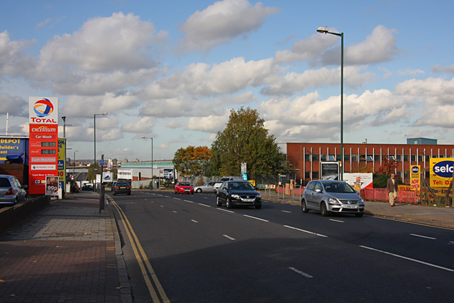
English: Edgware Road The A5 is called Edgware Road at a number of locations along its journey out of central London. Here, having been Cricklewood Broadway to the south, it will become West Hendon Broadway on the other side of the A406 North Circular Road as it continues north. |
| Date | 2009-10-23 |
| Source | From geograph.org.uk |
| Author | Martin Addison |
| ⧼wm-license-cc-attribution⧽ (قالب:I18n/Credit line) |
Martin Addison / Edgware Road / |
51°33′57″N 0°13′29″W / 51.56578°N 0.2247°W
_heading:337)
| Object location | ملف:Compass-icon bb NNW.svg | View all coordinates using: OpenStreetMap |
|---|
_heading:337.00&language=⧼lang⧽)
ترخيص
تاريخ الملف
اضغط على زمن/تاريخ لرؤية الملف كما بدا في هذا الزمن.
| زمن/تاريخ | صورة مصغرة | الأبعاد | مستخدم | تعليق | |
|---|---|---|---|---|---|
| حالي | ★ مراجعة معتمدة 23:33، 6 نوفمبر 2023 | | 640 × 427 (127 كيلوبايت) | Pastakhov (نقاش | مساهمات) | Upload https://upload.wikimedia.org/wikipedia/commons/8/89/Edgware_Road_-_geograph.org.uk_-_1556180.jpg |
لا يمكنك استبدال هذا الملف.
وصلات
لا يوجد صفحات تصل لهذه الصورة.