ملف:Dutch Brazil 1630-1654 map.svg

حجم معاينة PNG لذلك الملف ذي الامتداد SVG: 670 × 600 بكسل. البعد الآخر: 2٬288 × 2٬048 بكسل.
الملف الأصلي (ملف SVG، أبعاده 935 × 837 بكسل، حجم الملف: 1٫75 ميجابايت)
وصف قصير
قالب:Igen
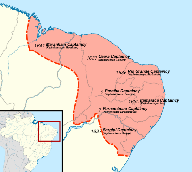
| Description |
English: Map of Dutch Brazil from 1630-1654, overlayed on a modern day map of Brazil. Referenced from Groote historische schoolatlas ten gebruike bij het onderwijs in de vaderlandsche en algemeene geschiedenis P42
Català: Extensió del Brasil neerlandès. |
| Date | 2022-01-12 |
| Source |
Own work قالب:Attrib |
| Author | Isochrone |
| ⧼wm-license-information-other-versions⧽ |
|
ترخيص
|
تاريخ الملف
اضغط على زمن/تاريخ لرؤية الملف كما بدا في هذا الزمن.
| زمن/تاريخ | صورة مصغرة | الأبعاد | مستخدم | تعليق | |
|---|---|---|---|---|---|
| حالي | ★ مراجعة معتمدة 00:16، 9 ديسمبر 2023 | | 935 × 837 (1٫75 ميجابايت) | Pastakhov (نقاش | مساهمات) | Upload https://upload.wikimedia.org/wikipedia/commons/0/06/Dutch_Brazil_1630-1654_map.svg |
لا يمكنك استبدال هذا الملف.
وصلات
لا يوجد صفحات تصل لهذه الصورة.