ملف:Devon Culm Subsoil - geograph.org.uk - 344702.jpg
حجم هذه المعاينة: 600 × 600 بكسل. البعد الآخر: 640 × 640 بكسل.
الملف الأصلي (640 × 640 بكسل حجم الملف: 153 كيلوبايت، نوع MIME: image/jpeg)
وصف قصير
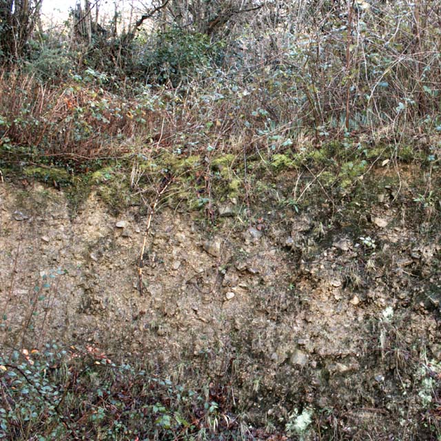
| Description |
English: Devon Culm Subsoil This is what is under your feet in this part of Devon. The subsoil is very stony and well-drained with a thin but fertile topsoil with a high clay content. This bank was cut into a fairly steep hillside. Agriculturally, this type of land is mainly used for grazing or forestry. |
| Date | 2007-02-22 |
| Source | From geograph.org.uk |
| Author | David Brinicombe |
| ⧼wm-license-cc-attribution⧽ (قالب:I18n/Credit line) |
David Brinicombe / Devon Culm Subsoil / |
| Object location | ملف:Compass-icon bb S.svg | View all coordinates using: OpenStreetMap |
|---|
_heading:180.00&language=⧼lang⧽)
ترخيص
تاريخ الملف
اضغط على زمن/تاريخ لرؤية الملف كما بدا في هذا الزمن.
| زمن/تاريخ | صورة مصغرة | الأبعاد | مستخدم | تعليق | |
|---|---|---|---|---|---|
| حالي | ★ مراجعة معتمدة 03:49، 31 أكتوبر 2023 | | 640 × 640 (153 كيلوبايت) | Pastakhov (نقاش | مساهمات) | Upload https://upload.wikimedia.org/wikipedia/commons/a/a4/Devon_Culm_Subsoil_-_geograph.org.uk_-_344702.jpg |
لا يمكنك استبدال هذا الملف.
وصلات
لا يوجد صفحات تصل لهذه الصورة.