ملف:Departements of French Empire South 1811-fr.svg
حجم معاينة PNG لذلك الملف ذي الامتداد SVG: 697 × 600 بكسل. البعد الآخر: 2٬379 × 2٬048 بكسل.


الملف الأصلي (ملف SVG، أبعاده 1٬020 × 878 بكسل، حجم الملف: 235 كيلوبايت)
وصف قصير
| Description |
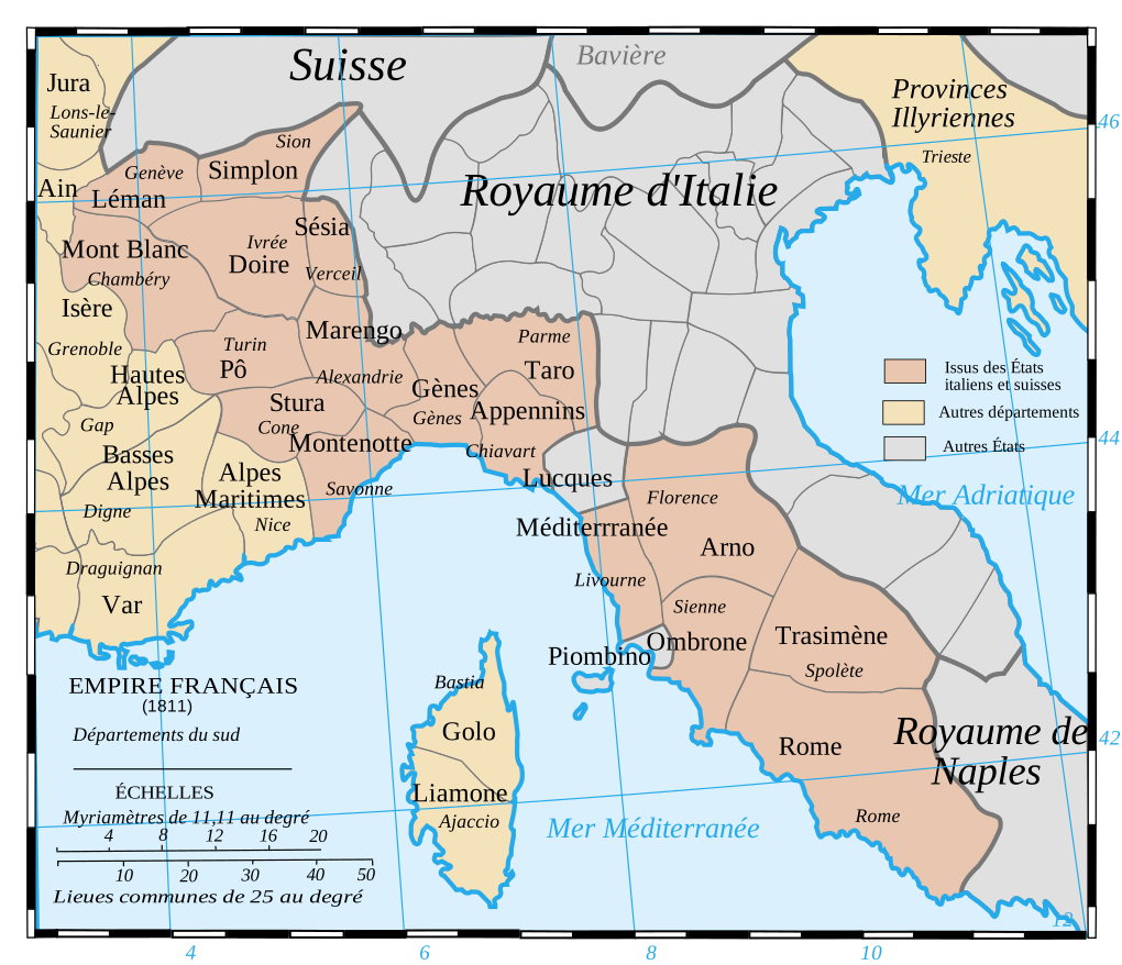
Français : Les départements du Sud du 1er Empire français (1811).
Attention: Cette carte est une carte historique. La qualité de sa précision ne permet pas une utilisation dans un contexte moderne.
English: French Departements of the South of the first Empire (1811)
Be careful: The map is an historical map. The precision is not sufficient for a modern use. |
| Date | 2008-09-29 |
| Source | Tiré d'une carte établie en 1811 par Messieurs Drioux et Leroy. |
| Author | Ewan ar Born |
| ⧼wm-license-information-other-versions⧽ |
|

 |
This vector image was created with Inkscape. |
قالب:Translation possibleقالب:Atelier graphique carte
ترخيص

|
تاريخ الملف
اضغط على زمن/تاريخ لرؤية الملف كما بدا في هذا الزمن.
| زمن/تاريخ | صورة مصغرة | الأبعاد | مستخدم | تعليق | |
|---|---|---|---|---|---|
| حالي | ★ مراجعة معتمدة 08:15، 13 أكتوبر 2023 | | 1٬020 × 878 (235 كيلوبايت) | Pastakhov (نقاش | مساهمات) | Upload https://upload.wikimedia.org/wikipedia/commons/7/7e/Departements_of_French_Empire_South_1811-fr.svg |
لا يمكنك استبدال هذا الملف.
وصلات
لا يوجد صفحات تصل لهذه الصورة.
