ملف:D'Arros and Saint Joseph map.png
حجم هذه المعاينة: 756 × 600 بكسل. البعد الآخر: 900 × 714 بكسل.
الملف الأصلي (900 × 714 بكسل حجم الملف: 637 كيلوبايت، نوع MIME: image/png)
وصف قصير
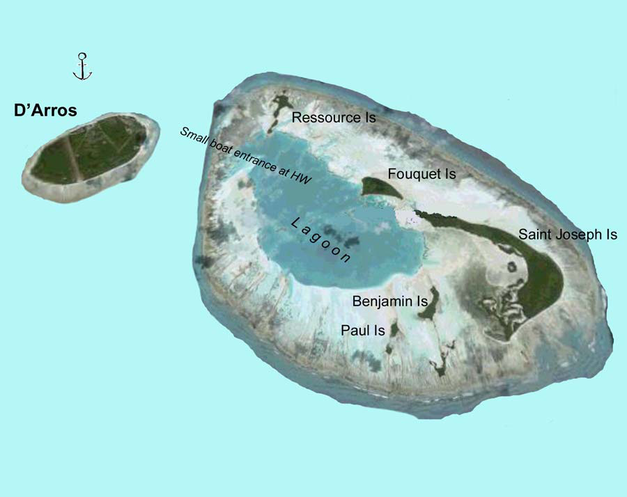
| Description |
English: Map of D'Arros Island or Arros Island (left) and Saint Joseph Atoll (right) — of the Amirante Islands group, which are part of the Outer Seychelles (Coralline Seychelles) archipelago of coral formation.
|
| Date | 2000 |
| Source | Sailing Directions (Enroute), Pub 171 Indian Ocean |
| Author | National Geospatial-Intelligence Agency |
ترخيص
تاريخ الملف
اضغط على زمن/تاريخ لرؤية الملف كما بدا في هذا الزمن.
| زمن/تاريخ | صورة مصغرة | الأبعاد | مستخدم | تعليق | |
|---|---|---|---|---|---|
| حالي | ★ مراجعة معتمدة 07:03، 4 نوفمبر 2023 | | 900 × 714 (637 كيلوبايت) | Pastakhov (نقاش | مساهمات) | Upload https://upload.wikimedia.org/wikipedia/commons/0/0c/D%27Arros_and_Saint_Joseph_map.png |
لا يمكنك استبدال هذا الملف.
وصلات
لا يوجد صفحات تصل لهذه الصورة.