ملف:Commune II (Niamey Map).png
لا توجد دقة أعلى متوفرة.
Commune_II_(Niamey_Map).png (800 × 600 بكسل حجم الملف: 16 كيلوبايت، نوع MIME: image/png)
وصف قصير
| Description |
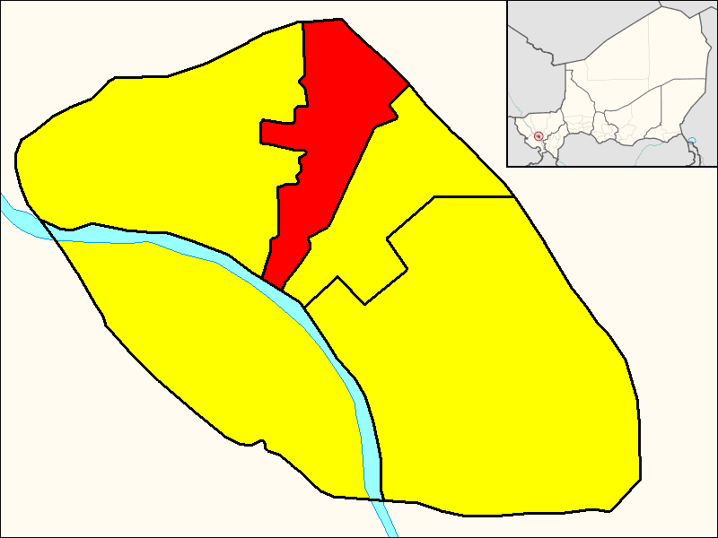
English: Map of the borough (commune) of Niamey II (shown in red) within the city of Niamey (yellow). Niger River is shown in the map. |
| Date | 2015-09-23 |
| Source | Own work. The map was derived searching for some city maps of Niamey. The little Nigerien map showing Niamey position derives from the File:Niamey in Niger (special_marker).svg by TUBS. |
| Author | Dэя-Бøяg |

|
[All images in this gallery should be recreated using vector graphics as an SVG file. This has several advantages; see Commons:Media for cleanup for more information. If an SVG form of this image is already available, please upload it. After uploading an SVG, replace this template with {{vector version available|new image name.svg}}.] Error: {{Lang}}: text has italic markup (help) |
|
العربية | български | català | čeština | dansk | Deutsch | English | Esperanto | español | français | galego | 한국어 | italiano | magyar | lietuvių | 日本語 | Plattdüütsch | Nederlands | norsk | polski | português | română | русский | suomi | svenska | Türkçe | українська | 中文(繁體) | 中文(简体) | +/− | |
ترخيص
|

.svg&action=edit&redlink=1)
تاريخ الملف
اضغط على زمن/تاريخ لرؤية الملف كما بدا في هذا الزمن.
| زمن/تاريخ | صورة مصغرة | الأبعاد | مستخدم | تعليق | |
|---|---|---|---|---|---|
| حالي | ★ مراجعة معتمدة 19:53، 25 أكتوبر 2023 | | 800 × 600 (16 كيلوبايت) | Pastakhov (نقاش | مساهمات) | Upload https://upload.wikimedia.org/wikipedia/commons/6/6b/Commune_II_%28Niamey_Map%29.png |
لا يمكنك استبدال هذا الملف.
وصلات
لا يوجد صفحات تصل لهذه الصورة.
.png&oldid=3253601)