ملف:Chile-Chonos Archipelago.jpg
حجم هذه المعاينة: 485 × 600 بكسل. البعد الآخر: 1٬032 × 1٬276 بكسل.
الملف الأصلي (1٬032 × 1٬276 بكسل حجم الملف: 572 كيلوبايت، نوع MIME: image/jpeg)
وصف قصير
| Description |
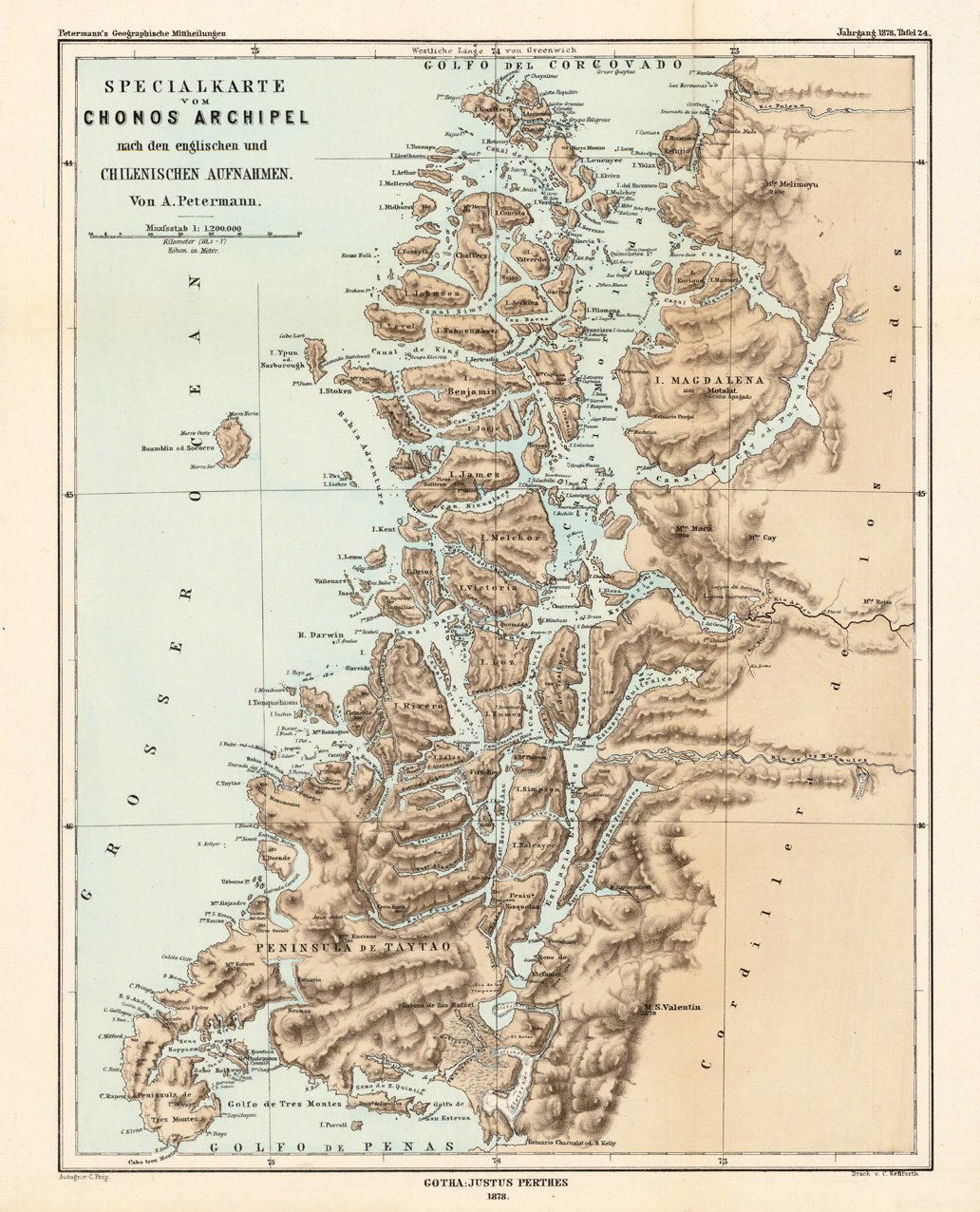
English: Lithograph, printed in colors when published. Detailled map, showing the Chonos Archipel from the gulf of Penas with the Peninsula de Taytao up to the gulf of Corcovado. Very detailled map with an enormous number of islands and peninsulas, most of them with place names. The map provides an overview of the results of the travel by Th. von Heugelin to Somalia. It is also ornated with a scene of birds and mammals, which were discovered by Th. Heugelin in Somalia. |
| Date | 1878 |
| Source | http://www.bergbook.com/htdocs/woda/data/demo/descriptions/17333.htm |
| Author | Petermann, A. |
ترخيص
هذه الصورة هي ضمن الملكية عامة بسبب إنتهاء فترة صلاحية حقوقها في الولايات المتحدة الأمريكية و أي دولة أخرى ينص قانونها على مرور 70 سنة كحد أعلى على وفاة المنتج لإنتهاء صلاحية الحقوق.
تاريخ الملف
اضغط على زمن/تاريخ لرؤية الملف كما بدا في هذا الزمن.
| زمن/تاريخ | صورة مصغرة | الأبعاد | مستخدم | تعليق | |
|---|---|---|---|---|---|
| حالي | ★ مراجعة معتمدة 11:30، 26 يناير 2024 | | 1٬032 × 1٬276 (572 كيلوبايت) | Pastakhov (نقاش | مساهمات) | Upload https://upload.wikimedia.org/wikipedia/commons/e/e2/Chile-Chonos_Archipelago.jpg |
لا يمكنك استبدال هذا الملف.
وصلات
لا يوجد صفحات تصل لهذه الصورة.