ملف:Cheviot Hills Banner.jpg
حجم هذه المعاينة: 800 × 115 بكسل. البعد الآخر: 3٬000 × 430 بكسل.
الملف الأصلي (3٬000 × 430 بكسل حجم الملف: 278 كيلوبايت، نوع MIME: image/jpeg)
وصف قصير
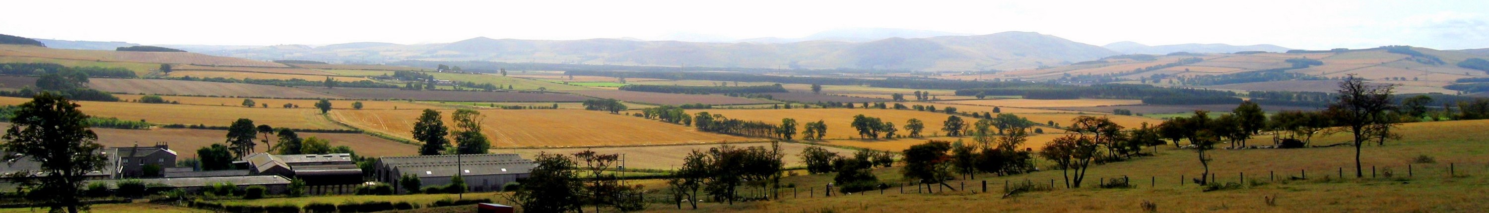
| Description |
English: Panoramic view of the Cheviots above Ford Hill farm Hedgehope and Cheviot itself are just visible in the far distance. The main hills visible are those on the northern edge of the Cheviot Hills seen over the flat extent of the Millfield Plain. This housed a large lake in prehistoric times, fed by the Rivers Till and Glen. |
| Date | 2003-09-12 |
| Source | قالب:Derived from |
| Author | Andrew Curtis |
| ⧼wm-license-information-other-versions⧽ | قالب:Extracted from |
| ⧼wm-license-cc-attribution⧽ (قالب:I18n/Credit line) |
Andrew Curtis / Panoramic view of the Cheviots above Ford Hill farm / |
55°37′55″N 2°04′31″W / 55.63190°N 2.0753°W
_heading:202)
| Object location | ملف:Compass-icon bb SSW.svg | View all coordinates using: OpenStreetMap |
|---|
_heading:202.00&language=⧼lang⧽)
ترخيص
تاريخ الملف
اضغط على زمن/تاريخ لرؤية الملف كما بدا في هذا الزمن.
| زمن/تاريخ | صورة مصغرة | الأبعاد | مستخدم | تعليق | |
|---|---|---|---|---|---|
| حالي | ★ مراجعة معتمدة 01:32، 20 أكتوبر 2023 | 3٬000 × 430 (278 كيلوبايت) | Pastakhov (نقاش | مساهمات) | Upload https://upload.wikimedia.org/wikipedia/commons/f/f9/Cheviot_Hills_Banner.jpg |
لا يمكنك استبدال هذا الملف.
وصلات
لا يوجد صفحات تصل لهذه الصورة.