ملف:Canada provinces 1867-1870.png
الملف الأصلي (1٬000 × 864 بكسل حجم الملف: 61 كيلوبايت، نوع MIME: image/png)
وصف قصير
| Description |
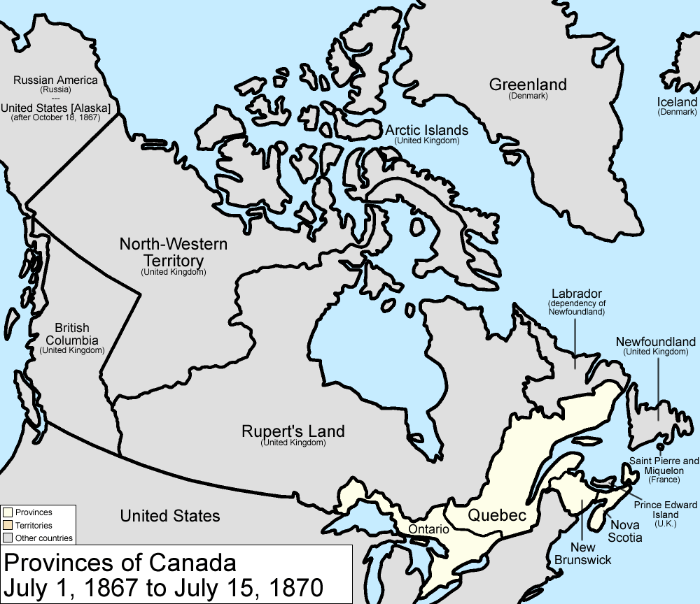
Map of the provinces of Canada as they were from 1867 to 1870. On July 2 1867, the Dominion of Canada was created from three provinces of British North America: Canada (split into the provinces of Ontario and Quebec), New Brunswick, and Nova Scotia. On July 14 1870, Rupert's Land and the North-Western Territories were ceded to Canada, and became the North-West Territories; a small square of this was made the province of Manitoba. Note that, to make for simpler mapping, the western and southwestern portions of the 1927 Privy Council "Coast of Labrador" boundary is used. For the southern boundary, from River Romaine east, Quebec's version of the boundary is used. Until 1927, Canada recognized only a tiny sliver along the Atlantic Ocean as belonging to Washington. Made by User:Golbez. |
| Date | قالب:Original upload date |
| Source | No machine-readable source provided. Own work assumed (based on copyright claims). |
| Author | No machine-readable author provided. Golbez assumed (based on copyright claims). |
ترخيص
قالب:Cc-by-sa-3.0-migrated |

تاريخ الملف
اضغط على زمن/تاريخ لرؤية الملف كما بدا في هذا الزمن.
| زمن/تاريخ | صورة مصغرة | الأبعاد | مستخدم | تعليق | |
|---|---|---|---|---|---|
| حالي | ★ مراجعة معتمدة 22:19، 19 يناير 2024 | | 1٬000 × 864 (61 كيلوبايت) | Pastakhov (نقاش | مساهمات) | Upload https://upload.wikimedia.org/wikipedia/commons/c/cf/Canada_provinces_1867-1870.png |
لا يمكنك استبدال هذا الملف.
وصلات
الصفحات التالية تحتوي على وصلة لهذه الصورة: