ملف:CalifSR49AmerMF.JPG
حجم هذه المعاينة: 800 × 600 بكسل. البعدان الآخران: 2٬560 × 1٬920 بكسل | 3٬648 × 2٬736 بكسل.
الملف الأصلي (3٬648 × 2٬736 بكسل حجم الملف: 4٫36 ميجابايت، نوع MIME: image/jpeg)
وصف قصير
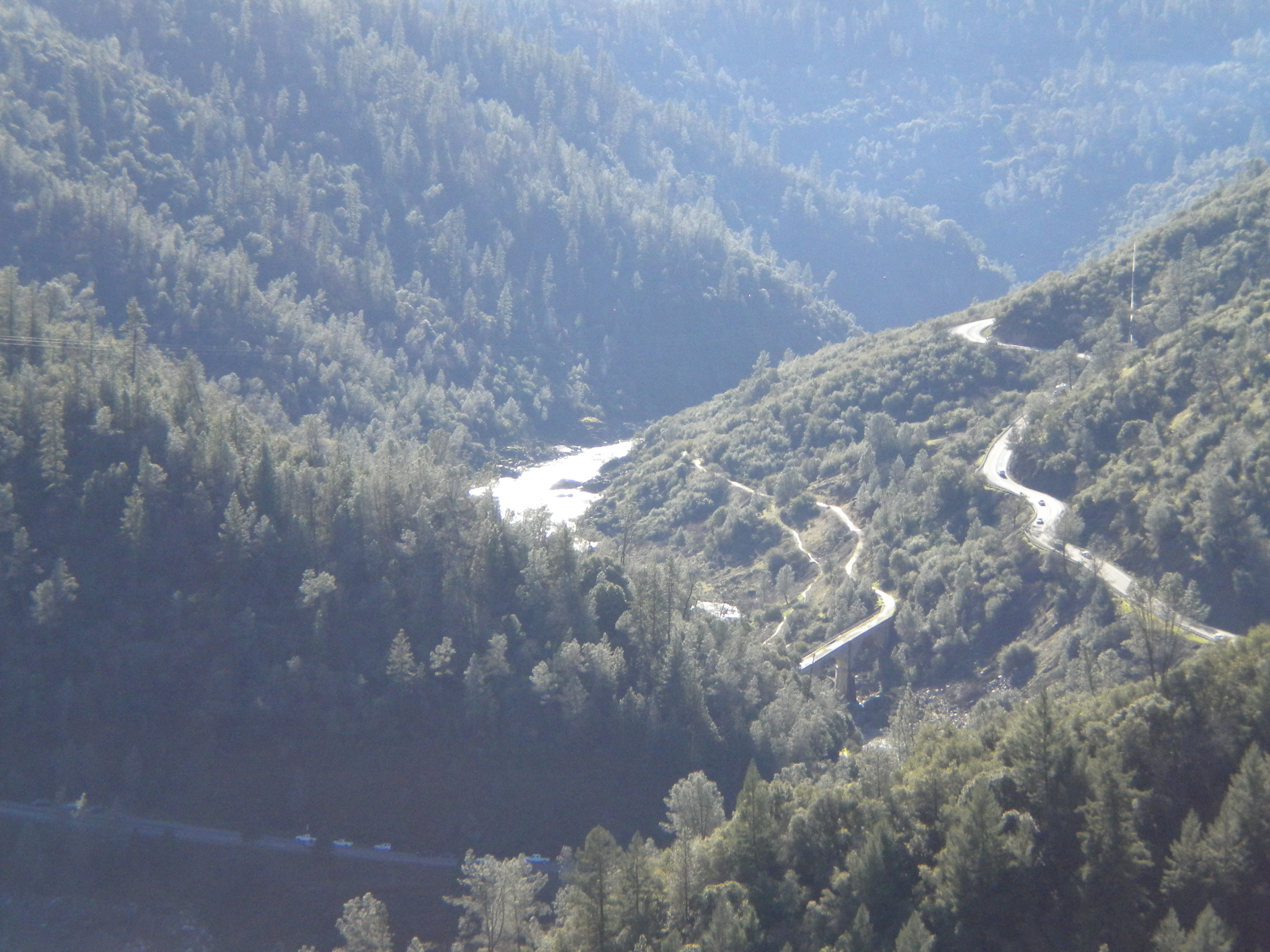
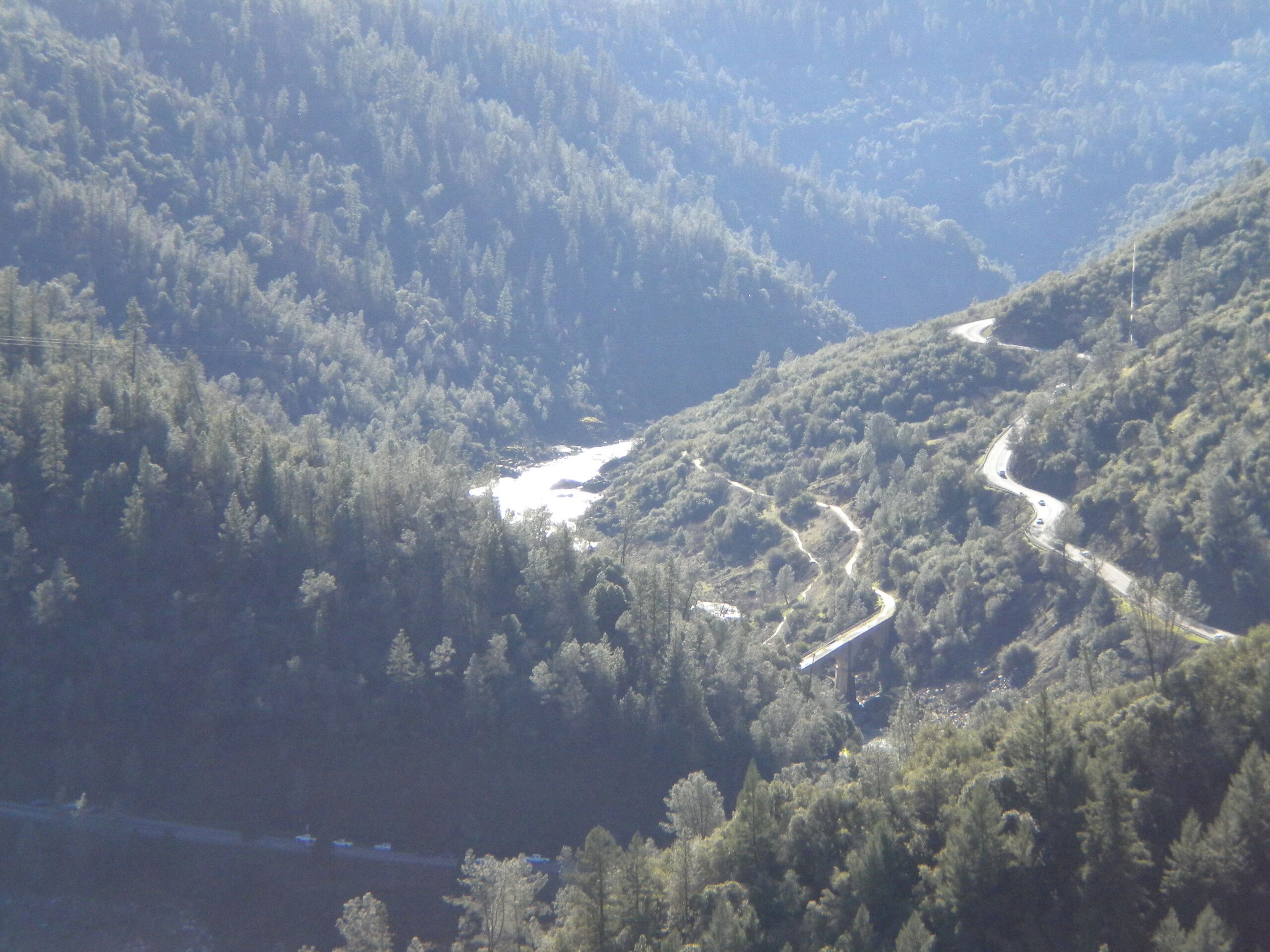
| Description | California State Routes 49 and 193, crossing the North/Middle Fork of the American River, looking south-southwest from the eastern terminus of the Foresthill Bridge. Auburn is forward and to the right, Cool a few miles to the left. The actual highway bridges and the confluence of the North and Middle Forks are unseen behind the ridge in front (the bridge near the middle of the picture is the Mountain Quarries Bridge, a former railroad bridge and a historical landmark). |
| Date | قالب:Original upload date |
| Source | قالب:Own work by original uploader |
| Author | خطأ: لا توجد وحدة بهذا الاسم "user". |
38°55′21″N 121°02′03″W / 38.9225°N 121.0341°W
ترخيص
تاريخ الملف
اضغط على زمن/تاريخ لرؤية الملف كما بدا في هذا الزمن.
| زمن/تاريخ | صورة مصغرة | الأبعاد | مستخدم | تعليق | |
|---|---|---|---|---|---|
| حالي | ★ مراجعة معتمدة 12:15، 26 يناير 2024 | | 3٬648 × 2٬736 (4٫36 ميجابايت) | Pastakhov (نقاش | مساهمات) | Upload https://upload.wikimedia.org/wikipedia/commons/1/1e/CalifSR49AmerMF.JPG |
لا يمكنك استبدال هذا الملف.
وصلات
لا يوجد صفحات تصل لهذه الصورة.