ملف:CUF-Cincinnati-map.jpg
حجم هذه المعاينة: 800 × 507 بكسل. البعد الآخر: 1٬332 × 844 بكسل.
الملف الأصلي (1٬332 × 844 بكسل حجم الملف: 408 كيلوبايت، نوع MIME: image/jpeg)

|
[All images in this gallery should be recreated using vector graphics as an SVG file. This has several advantages; see Commons:Media for cleanup for more information. If an SVG form of this image is already available, please upload it. After uploading an SVG, replace this template with {{vector version available|new image name.svg}}.] Error: {{Lang}}: text has italic markup (help) |
|
العربية | български | català | čeština | dansk | Deutsch | English | Esperanto | español | français | galego | 한국어 | italiano | magyar | lietuvių | 日本語 | Plattdüütsch | Nederlands | norsk | polski | português | română | русский | suomi | svenska | Türkçe | українська | 中文(繁體) | 中文(简体) | +/− | |
وصف قصير
| Description |
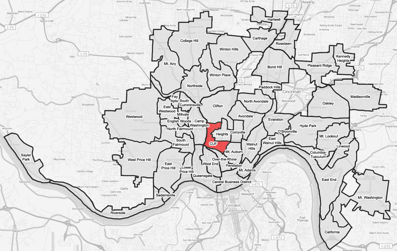
English: A map of the neighborhood of Avondale within Cincinnati, Ohio. Neighborhood lines are based on information from http://www.cincinnati-oh.gov/police/pages/-5095-/. This street map is derived from a free http://www.openstreetmap.org/ map. |
||
| Date | 2008-08-03 | ||
| Source | Own work | ||
| Author | Wholtone | ||
| ⧼wm-license-information-permission⧽ (⧼wm-license-information-permission-reusing-text⧽) |
|
ترخيص
تاريخ الملف
اضغط على زمن/تاريخ لرؤية الملف كما بدا في هذا الزمن.
| زمن/تاريخ | صورة مصغرة | الأبعاد | مستخدم | تعليق | |
|---|---|---|---|---|---|
| حالي | ★ مراجعة معتمدة 17:07، 23 نوفمبر 2023 | | 1٬332 × 844 (408 كيلوبايت) | Pastakhov (نقاش | مساهمات) | Upload https://upload.wikimedia.org/wikipedia/commons/e/e2/CUF-Cincinnati-map.jpg |
لا يمكنك استبدال هذا الملف.
وصلات
لا يوجد صفحات تصل لهذه الصورة.