ملف:Buurtspoorwegen Oost-Vlaanderen.png
حجم هذه المعاينة: 742 × 600 بكسل. البعد الآخر: 2٬230 × 1٬803 بكسل.
الملف الأصلي (2٬230 × 1٬803 بكسل حجم الملف: 1٫6 ميجابايت، نوع MIME: image/png)
وصف قصير
| Description |
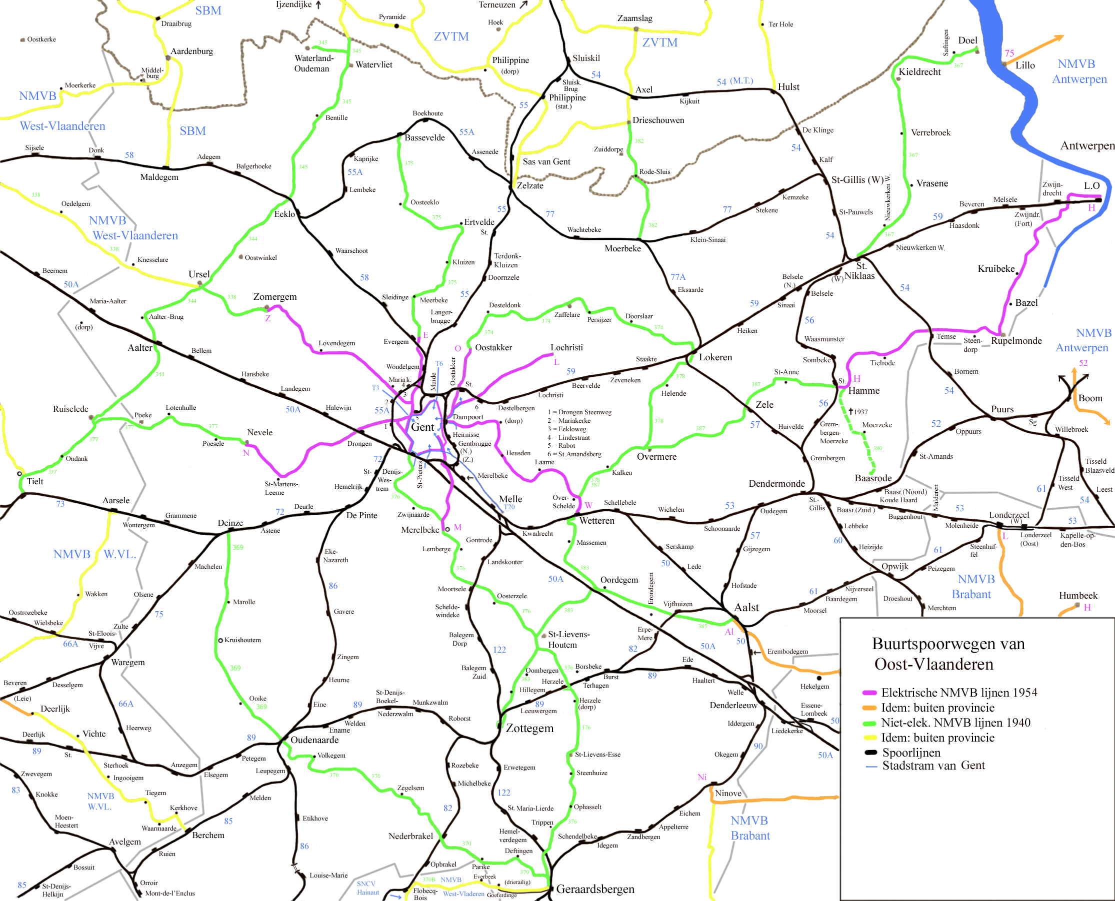
English: Map off the vicinal railways in the province off East Flandres.
(Dutch)
|
| Date | 8-1-2009 |
| Source | Own work |
| Author | Smiley.toerist |
| ⧼wm-license-information-other-versions⧽ | Detail Ghent |
ترخيص
|

تاريخ الملف
اضغط على زمن/تاريخ لرؤية الملف كما بدا في هذا الزمن.
| زمن/تاريخ | صورة مصغرة | الأبعاد | مستخدم | تعليق | |
|---|---|---|---|---|---|
| حالي | ★ مراجعة معتمدة 08:40، 8 ديسمبر 2023 | | 2٬230 × 1٬803 (1٫6 ميجابايت) | Pastakhov (نقاش | مساهمات) | Upload https://upload.wikimedia.org/wikipedia/commons/3/33/Buurtspoorwegen_Oost-Vlaanderen.png |
لا يمكنك استبدال هذا الملف.
وصلات
لا يوجد صفحات تصل لهذه الصورة.