ملف:British Irish isles.png
حجم هذه المعاينة: 343 × 599 بكسل. البعد الآخر: 1٬276 × 2٬230 بكسل.
الملف الأصلي (1٬276 × 2٬230 بكسل حجم الملف: 435 كيلوبايت، نوع MIME: image/png)
وصف قصير
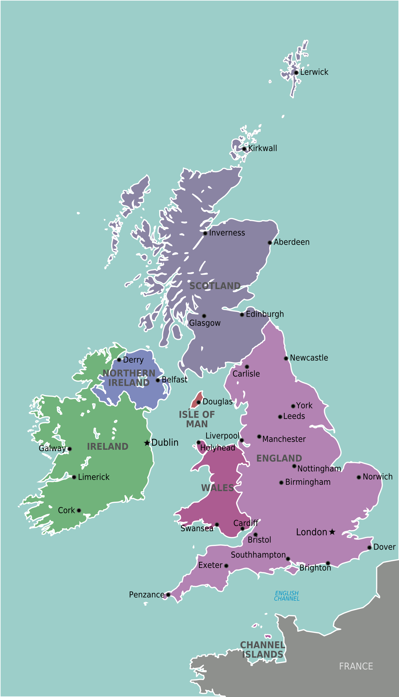
| Description | Map of The British & Irish Isles for use on Wikivoyage, English version |
| Date | 6 February |
| Source | Own work based on the map of UK |
| Author | Stefan Ertmann, amendments by Peterfitzgerald |
| ⧼wm-license-information-other-versions⧽ |
.png&action=edit&redlink=1)
ترخيص

|
قالب:Original upload log
Wikivoyage has a travel guide for wts.
قالب:Original description page
- 2009-02-05 23:26 (WT-shared) Sertmann[dead link] 675×1129 (224851 bytes) {{Imagecredit|credit=Stefan Ertmann|captureDate=6 February|location=Europe|source=http://commons.wikimedia.org/wiki/File:British_Isles_Unite (Import from wikitravel.org/shared)
- 2009-07-13 22:29 (WT-shared) Peterfitzgerald Archive copy at the Internet Archive 1134×1982 (404899 bytes) +more English cities (Import from wikitravel.org/shared)
- 2012-09-09 22:15 Atsirlin[dead link] 1276×2230 (445408 bytes) cleanup
تاريخ الملف
اضغط على زمن/تاريخ لرؤية الملف كما بدا في هذا الزمن.
| زمن/تاريخ | صورة مصغرة | الأبعاد | مستخدم | تعليق | |
|---|---|---|---|---|---|
| حالي | ★ مراجعة معتمدة 09:04، 2 نوفمبر 2023 | | 1٬276 × 2٬230 (435 كيلوبايت) | Pastakhov (نقاش | مساهمات) | Upload https://upload.wikimedia.org/wikipedia/commons/6/63/British_Irish_isles.png |
لا يمكنك استبدال هذا الملف.
وصلات
لا يوجد صفحات تصل لهذه الصورة.