ملف:BritishWestFlorida1776.jpg
حجم هذه المعاينة: 800 × 415 بكسل. البعد الآخر: 1٬752 × 908 بكسل.
الملف الأصلي (1٬752 × 908 بكسل حجم الملف: 597 كيلوبايت، نوع MIME: image/jpeg)
وصف قصير
| Description |
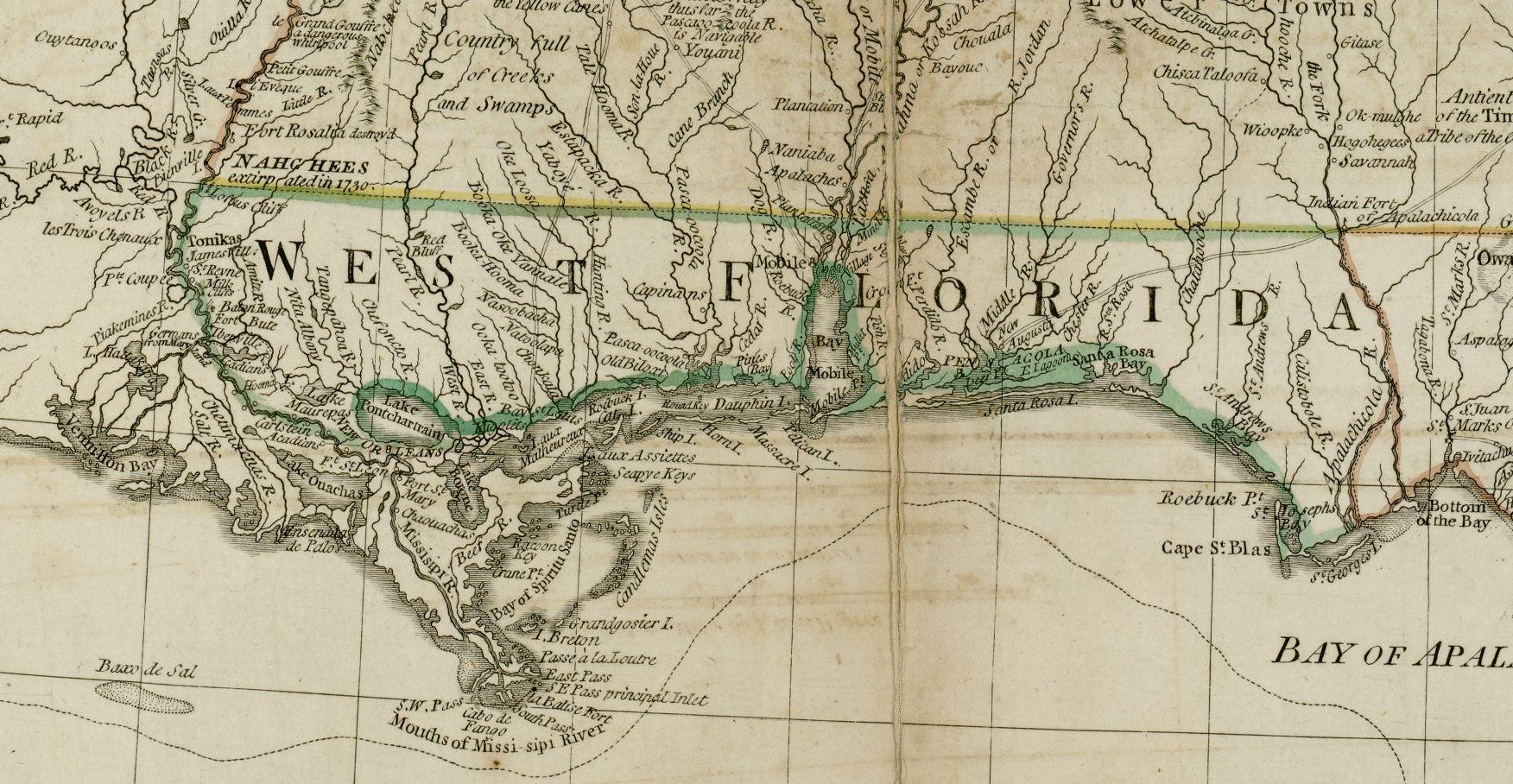
English: The source map depicts the southern British colonies in 1776, including the Carolinas, Georgia, and the Floridas, as well as labeling Indian tribal regions. This detail depicts British West Florida, roughly including the Gulf Coast between the Mississippi River and the Apalachicola River. |
| Date | 1776 |
| Source | From the Darlington Digital Library at the University of Pittsburgh, identifier DARMAP0298: http://images.library.pitt.edu/cgi-bin/i/image/image-idx?med=1;image_search%20btn=Go;q1=florida;rgn1=darlmaps_all;sid=9f1d2a0afbb2d02f51e12f6a87a01616;size=20;c=darlmaps;lasttype=boolean;view=entry;lastview=thumbnail;subview=detail;cc=darlmaps;entryid=x-darmap0298;viewid=DARMAP0298.TIF;start=1;resnum=7 |
| Author | Bernard Romans |
ترخيص
|
|
This file is in the ملكية عامة because its copyright has expired in the United States and those countries with a copyright term of no more than the life of the author plus 100 years.
|
تاريخ الملف
اضغط على زمن/تاريخ لرؤية الملف كما بدا في هذا الزمن.
| زمن/تاريخ | صورة مصغرة | الأبعاد | مستخدم | تعليق | |
|---|---|---|---|---|---|
| حالي | ★ مراجعة معتمدة 04:27، 29 نوفمبر 2023 | | 1٬752 × 908 (597 كيلوبايت) | Pastakhov (نقاش | مساهمات) | Upload https://upload.wikimedia.org/wikipedia/commons/c/cf/BritishWestFlorida1776.jpg |
لا يمكنك استبدال هذا الملف.
وصلات
لا يوجد صفحات تصل لهذه الصورة.
تصنيفات:
- Old maps showing the history of the former colonies of the United Kingdom
- West Florida
- Old maps of Alabama
- Old maps of Mississippi (state)
- Old maps of Louisiana
- 1776 maps of Louisiana
- 1770s maps of Mississippi
- 1770s maps of Alabama
- 1776 maps of Florida
- Old maps of the Mississippi River
- Natchez people
- Tunica tribe
- Natchez, Mississippi