ملف:Battersea Power Station - geograph.org.uk - 829933.jpg
لا توجد دقة أعلى متوفرة.
Battersea_Power_Station_-_geograph.org.uk_-_829933.jpg (640 × 480 بكسل حجم الملف: 58 كيلوبايت، نوع MIME: image/jpeg)
وصف قصير
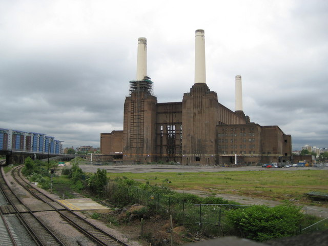
| Description | Battersea Power Station viewed from the south. On the left is the final merger of Southern's lines for Southern's main terminus (Victoria Station) which is the next station along the line to the north. Far left: Warwick and Howard Buildings, Chelsea Bridge Wharf (apartments). |
| Date | 2008-05-28 |
| Source | From geograph.org.uk; transferred by User:Fintan264 using geograph_org2commons. |
| Author | Nigel Cox |
| ⧼wm-license-information-permission⧽ (⧼wm-license-information-permission-reusing-text⧽) |
Creative Commons Attribution Share-alike license 2.0 |
| ⧼wm-license-cc-attribution⧽ (قالب:I18n/Credit line) |
Nigel Cox / Battersea Power Station / |
| Object location | ملف:Compass-icon bb N.svg | View all coordinates using: OpenStreetMap |
|---|
_region:GB-ENG_heading:0.00&language=⧼lang⧽)
ترخيص
تاريخ الملف
اضغط على زمن/تاريخ لرؤية الملف كما بدا في هذا الزمن.
| زمن/تاريخ | صورة مصغرة | الأبعاد | مستخدم | تعليق | |
|---|---|---|---|---|---|
| حالي | ★ مراجعة معتمدة 05:28، 17 أكتوبر 2023 | | 640 × 480 (58 كيلوبايت) | Pastakhov (نقاش | مساهمات) | Upload https://upload.wikimedia.org/wikipedia/commons/a/a2/Battersea_Power_Station_-_geograph.org.uk_-_829933.jpg |
لا يمكنك استبدال هذا الملف.
وصلات
لا يوجد صفحات تصل لهذه الصورة.