ملف:Antananarivo in Madagascar ESA23267313.jpeg
حجم هذه المعاينة: 800 × 591 بكسل. البعدان الآخران: 2٬560 × 1٬891 بكسل | 5٬097 × 3٬765 بكسل.
الملف الأصلي (5٬097 × 3٬765 بكسل حجم الملف: 9٫99 ميجابايت، نوع MIME: image/jpeg)
وصف قصير
| Description |
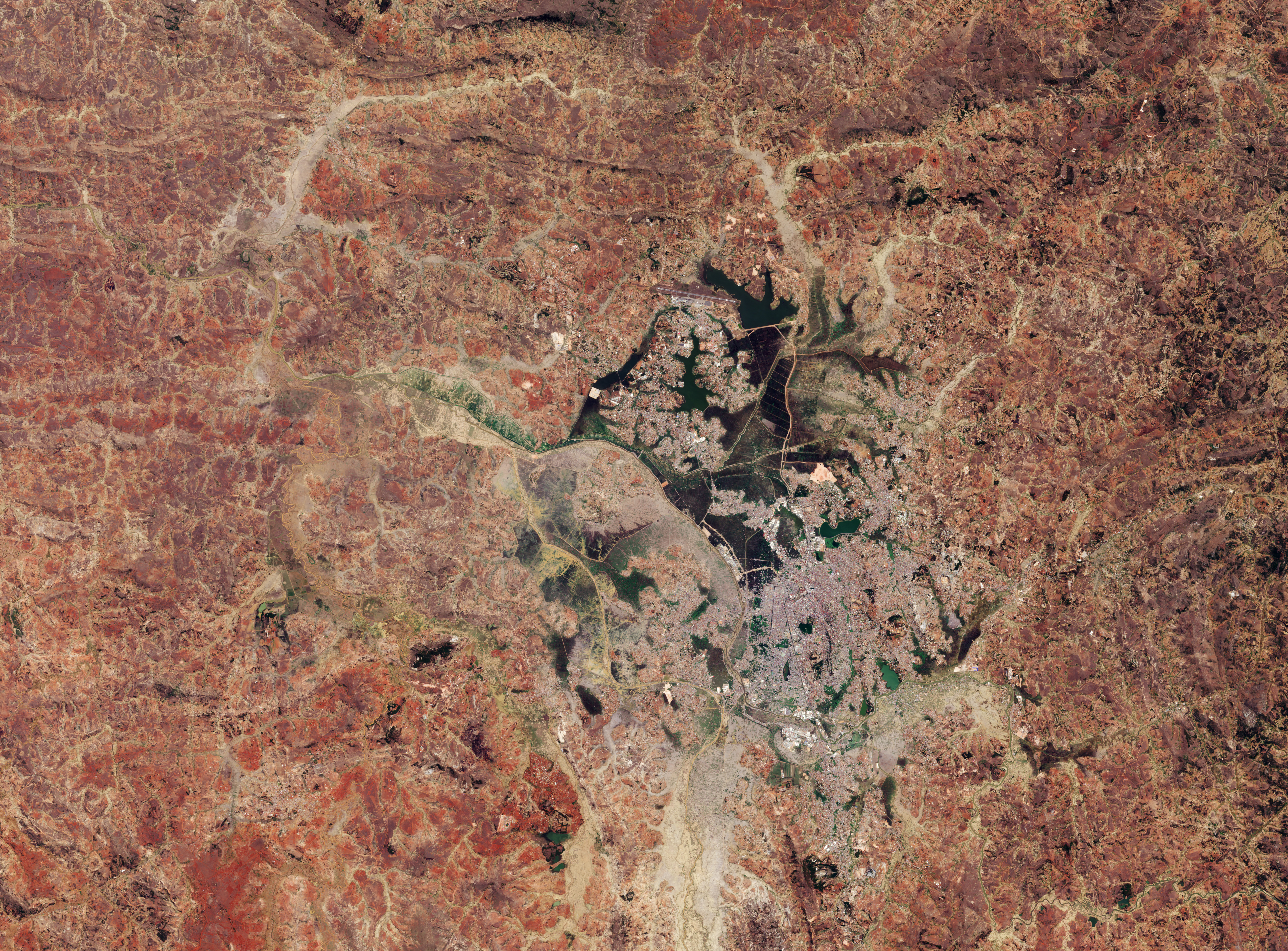
English: Captured by Copernicus Sentinel-2 on 28 September 2017, this image shows Antananarivo, the capital city of Madagascar, and surrounding area. Cultivated fields can be seen clearly north of the Ikopa River. Sentinel-2 is a two-satellite mission to supply the coverage and data delivery needed for Europe’s Copernicus programme. The mission’s frequent revisits over the same area and high spatial resolution allow changes in the way land is being used to be monitored. ESA and the United Nations Food and Agriculture Organization (FAO) have teamed up to exploit their particular fields of expertise to better address major global issues such as food security, and to take further advantage of the digital transformation in agriculture. Read full story: ESA and FAO unite to tackle food security and more |
| Date | قالب:Upload date |
| Source | Antananarivo in Madagascar |
| Author | European Space Agency |
| Activity | Observing the Earth |
| Mission | Sentinel-2 |
| System | Copernicus |
ترخيص
تاريخ الملف
اضغط على زمن/تاريخ لرؤية الملف كما بدا في هذا الزمن.
| زمن/تاريخ | صورة مصغرة | الأبعاد | مستخدم | تعليق | |
|---|---|---|---|---|---|
| حالي | ★ مراجعة معتمدة 08:38، 8 يوليو 2025 | | 5٬097 × 3٬765 (9٫99 ميجابايت) | Pastakhov (نقاش | مساهمات) | Upload https://upload.wikimedia.org/wikipedia/commons/a/ad/Antananarivo_in_Madagascar_ESA23267313.jpeg |
لا يمكنك استبدال هذا الملف.
وصلات
لا يوجد صفحات تصل لهذه الصورة.