ملف:Anhalt1847-63.jpg
لا توجد دقة أعلى متوفرة.
Anhalt1847-63.jpg (632 × 384 بكسل حجم الملف: 77 كيلوبايت، نوع MIME: image/jpeg)
وصف قصير
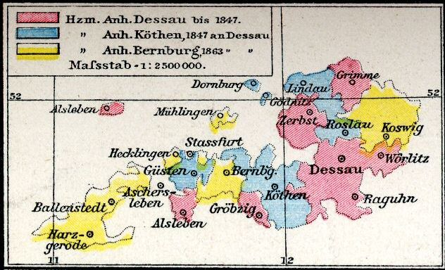
| Description | Map of Anhalt, 1847-1918 |
| Date |
|
| Source | scanned from Droysens Allgemeiner Historischer Handatlas |
| Author | Nick Wedd |
| ⧼wm-license-information-permission⧽ (⧼wm-license-information-permission-reusing-text⧽) |
The book, published in 1886, is out of copyright. I created the image myself. See below. |
ترخيص
|


تاريخ الملف
اضغط على زمن/تاريخ لرؤية الملف كما بدا في هذا الزمن.
| زمن/تاريخ | صورة مصغرة | الأبعاد | مستخدم | تعليق | |
|---|---|---|---|---|---|
| حالي | ★ مراجعة معتمدة 04:35، 9 نوفمبر 2023 | | 632 × 384 (77 كيلوبايت) | Pastakhov (نقاش | مساهمات) | Upload https://upload.wikimedia.org/wikipedia/commons/b/b0/Anhalt1847-63.jpg |
لا يمكنك استبدال هذا الملف.
وصلات
لا يوجد صفحات تصل لهذه الصورة.
