ملف:Airborne Lidar Bathymetric Technology.jpg
حجم هذه المعاينة: 800 × 467 بكسل. البعد الآخر: 850 × 496 بكسل.

الملف الأصلي (850 × 496 بكسل حجم الملف: 114 كيلوبايت، نوع MIME: image/jpeg)
قالب:Attribution metadata from licensed image
وصف قصير
| Description |
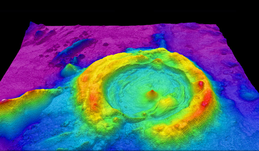
English: High-resolution multibeam lidar map showing spectacularly faulted and deformed seafloor geology, in shaded relief and coloured by depth |
| Date | 2013-07-12 |
| Source | https://www.flickr.com/photos/oceanexplorergov/9267768683/ |
| Author | NOAA Ocean Exploration & Research |
ترخيص
 |
This image is a work of the National Oceanic and Atmospheric Administration, taken or made as part of that person's official duties. As works of the U.S. federal government, all NOAA images are in the public domain in the United States. |  |
  
|
تاريخ الملف
اضغط على زمن/تاريخ لرؤية الملف كما بدا في هذا الزمن.
| زمن/تاريخ | صورة مصغرة | الأبعاد | مستخدم | تعليق | |
|---|---|---|---|---|---|
| حالي | ★ مراجعة معتمدة 02:52، 11 أكتوبر 2023 | | 850 × 496 (114 كيلوبايت) | Pastakhov (نقاش | مساهمات) | Upload https://upload.wikimedia.org/wikipedia/commons/c/c4/Airborne_Lidar_Bathymetric_Technology.jpg |
لا يمكنك استبدال هذا الملف.
وصلات
لا يوجد صفحات تصل لهذه الصورة.
