ملف:Aerial image of Alicudi (view from the south).jpg
حجم هذه المعاينة: 800 × 539 بكسل. البعدان الآخران: 2٬560 × 1٬724 بكسل | 4٬900 × 3٬300 بكسل.
الملف الأصلي (4٬900 × 3٬300 بكسل حجم الملف: 5٫15 ميجابايت، نوع MIME: image/jpeg)
وصف قصير
| Description |
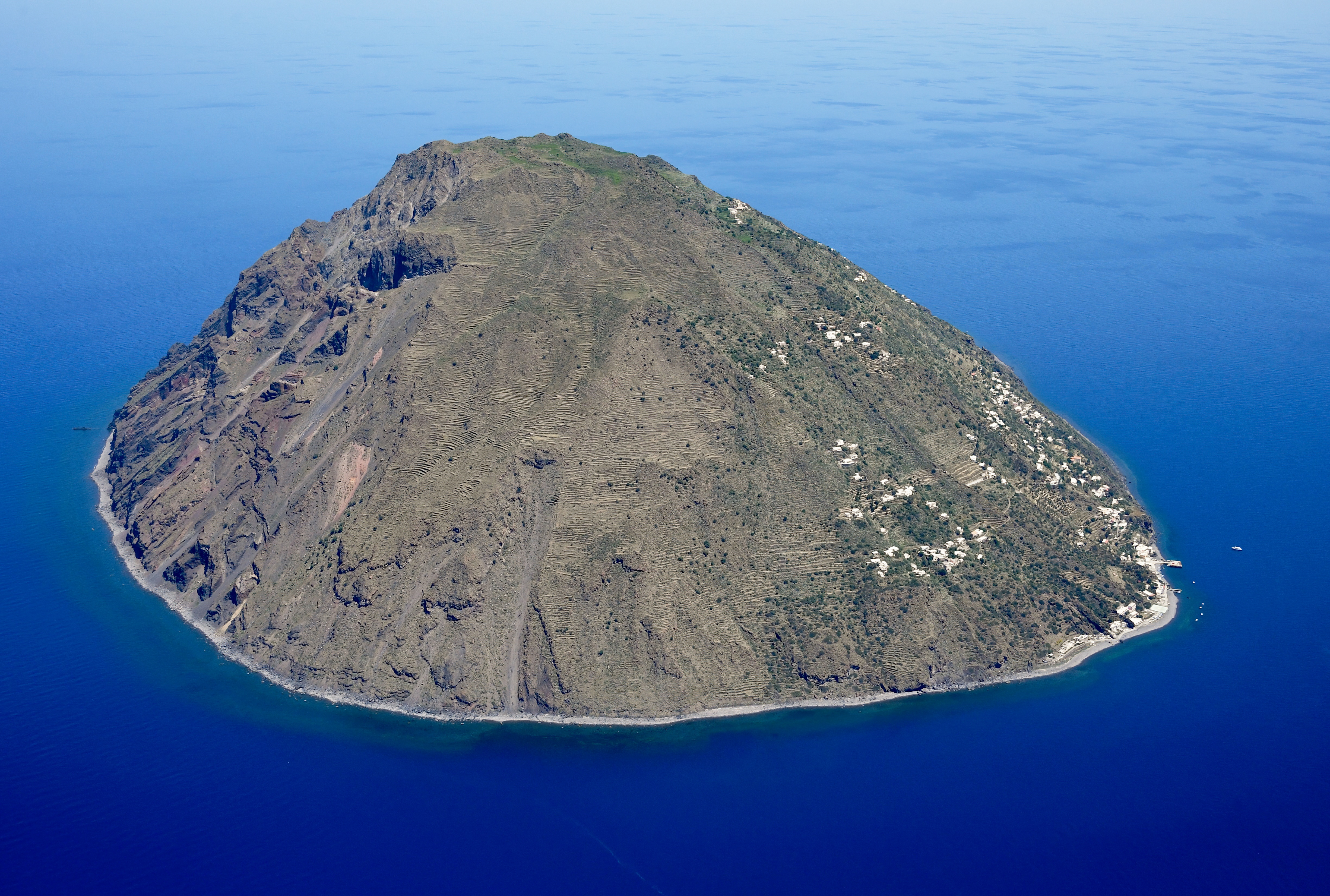
English: Aerial image of Alicudi (view from the south)
Deutsch: Luftbild von Alicudi (Ansicht von Süden) |
| Date | 2022-05-22 11:56:45 |
| Source | Own work |
| Author | Carsten Steger |
38°30′38″N 14°20′16″E / 38.510556°N 14.337778°E
.jpg¶ms=38.510556_N_14.337778_E_heading:20)
| Object location | | View all coordinates using: OpenStreetMap |
|---|
.jpg¶ms=038.541722_N_0014.352444_E_globe:Earth_class:object_type:object__&language=⧼lang⧽)
قالب:Assessment
|
ترخيص
|
تاريخ الملف
اضغط على زمن/تاريخ لرؤية الملف كما بدا في هذا الزمن.
| زمن/تاريخ | صورة مصغرة | الأبعاد | مستخدم | تعليق | |
|---|---|---|---|---|---|
| حالي | ★ مراجعة معتمدة 20:10، 9 نوفمبر 2023 | | 4٬900 × 3٬300 (5٫15 ميجابايت) | Pastakhov (نقاش | مساهمات) | Upload https://upload.wikimedia.org/wikipedia/commons/b/b4/Aerial_image_of_Alicudi_%28view_from_the_south%29.jpg |
لا يمكنك استبدال هذا الملف.
وصلات
لا يوجد صفحات تصل لهذه الصورة.
معلومات الصورة (ميتا)
.jpg&oldid=3433726)
تصنيفات:
- Pages using gadget WikiMiniAtlas
- Assessment tagged pages that are not in the file namespace
- Broken FPC links
- Self-published work
- Alicudi
- Aerial photographs of the Aeolian Islands
- Italy photographs taken on 2022-05-22
- May 2022 in Sicily
- Quality images of Sicily
- Featured pictures of Sicily
- Featured pictures of mountains
- Featured pictures of islands
- Featured pictures of volcanoes
- صفحات مع الخرائط