ملف:23December2017ThomasFire.tif

حجم معاينة PNG لذلك الملف ذي الامتداد TIF: 800 × 427 بكسل.
الملف الأصلي (1٬916 × 1٬023 بكسل حجم الملف: 7٫48 ميجابايت، نوع MIME: image/tiff)
وصف قصير
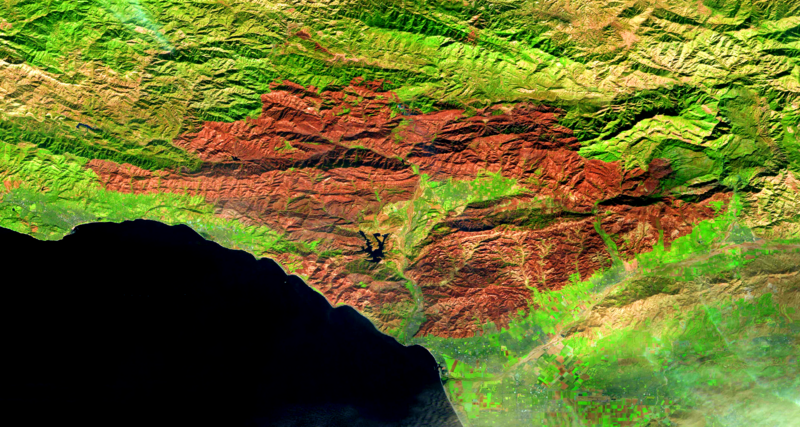
| Description |
English: Thomas Fire satellite image, December 23, 2017, ESA Sentinel, data source https://earthexplorer.usgs.gov/ |
| Date | 2017-12-23 |
| Source | Own work |
| Author | Earthyguy |
34°10′54″N 119°13′47″W / 34.1818°N 119.2298°W ESA Sentinel-2, data source https://earthexplorer.usgs.gov/
ترخيص
|
تاريخ الملف
اضغط على زمن/تاريخ لرؤية الملف كما بدا في هذا الزمن.
| زمن/تاريخ | صورة مصغرة | الأبعاد | مستخدم | تعليق | |
|---|---|---|---|---|---|
| حالي | ★ مراجعة معتمدة 13:13، 29 نوفمبر 2023 |  | 1٬916 × 1٬023 (7٫48 ميجابايت) | Pastakhov (نقاش | مساهمات) | Upload https://upload.wikimedia.org/wikipedia/commons/0/0c/23December2017ThomasFire.tif |
لا يمكنك استبدال هذا الملف.
وصلات
لا يوجد صفحات تصل لهذه الصورة.