ملف:2012 Ghanaian General Election Map.png
لا توجد دقة أعلى متوفرة.
2012_Ghanaian_General_Election_Map.png (430 × 600 بكسل حجم الملف: 70 كيلوبايت، نوع MIME: image/png)
وصف قصير
Look also: User:Berkaysnklf/Elections
This vector image was also created with PhotoScape.
| Description |
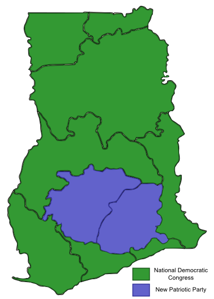
English: Map, showing the results of the Ghanaian General Election, 2012 by Regions of Ghana.
Attribution for the Borderlands of Ghana map: Thfc. |
| Date | 2012-12-25 20:23:44 |
| Source | Own work |
| Author | User:Berkaysnklf |
| ⧼wm-license-information-permission⧽ (⧼wm-license-information-permission-reusing-text⧽) |
مستخدم:Berkaysnklf/ElectionsTemplate |
| ⧼wm-license-information-other-versions⧽ |
|
|
|
This image was created with Inkscape. |
This vector image was also created with PhotoScape.
ترخيص
|
تاريخ الملف
اضغط على زمن/تاريخ لرؤية الملف كما بدا في هذا الزمن.
| زمن/تاريخ | صورة مصغرة | الأبعاد | مستخدم | تعليق | |
|---|---|---|---|---|---|
| حالي | ★ مراجعة معتمدة 23:34، 7 أكتوبر 2023 | | 430 × 600 (70 كيلوبايت) | Pastakhov (نقاش | مساهمات) | Upload https://upload.wikimedia.org/wikipedia/commons/1/13/2012_Ghanaian_General_Election_Map.png |
لا يمكنك استبدال هذا الملف.
وصلات
لا يوجد صفحات تصل لهذه الصورة.