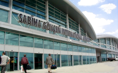
مطار صبيحة گوقچن الدولي
İstanbul Sabiha Gökçen International Airport Sabiha Gökçen Havalimanı | |||||||||||
|---|---|---|---|---|---|---|---|---|---|---|---|
| الملخص | |||||||||||
| نوع المطار | Public | ||||||||||
| المشغل | Limak-GMR-MAHB Consortium, ISG | ||||||||||
| الموقع | Pendik, İstanbul, Turkey | ||||||||||
| المنسوب AMSL | 312 ft / 95 m | ||||||||||
| الإحداثيات | 40°53′54″N 029°18′33″E / 40.89833°N 29.30917°E | ||||||||||
| Website | http://www.sabihagokcen.aero/ | ||||||||||
| خطأ: الوظيفة "auto" غير موجودة. | |||||||||||
| خطأ: الوظيفة "autocaption" غير موجودة. | |||||||||||
| Runways | |||||||||||
| |||||||||||
Sabiha Gökçen International Airport (IATA: SAW, ICAO: LTFJ) is one of the airports serving İstanbul, Turkey. The facility is named after Sabiha Gökçen, the first female combat pilot in the world. Located 35 km (22 mi) southeast[1] of central İstanbul, it is on the Asian side of the bi-continental city. It was built because the Atatürk International Airport (on the European side) was not large enough to meet the booming passenger demands (both domestic and international). SAW's international terminal capacity was 3 million passengers per year and the domestic terminal capacity was 0.5 million passengers per year. In June 2007, Turkish conglomerate Limak, India's GMR Group and Malaysia Airport Holding Berhad (MAHB) consortium gained the contract for upgrading and maintaining the airport. In mid-2008, ground was broken to upgrade the international terminal to handle 25 million passengers annually.
