ملف:Zaporizhzhia region.png
حجم هذه المعاينة: 638 × 599 بكسل. البعد الآخر: 2٬210 × 2٬076 بكسل.
الملف الأصلي (2٬210 × 2٬076 بكسل حجم الملف: 781 كيلوبايت، نوع MIME: image/png)
 |
A vector version of this image is also available, and should be used in place of this raster image where the raster image contains information that could be stored more efficiently and/or accurately in the SVG format, as a vector graphic.
If its license requires the preservation of attribution or revision history, the raster version of this image should not be deleted, in order to maintain this information. For more information, see the documentation on MediaWiki's support of SVG images. |
 |
وصف قصير
| Description |
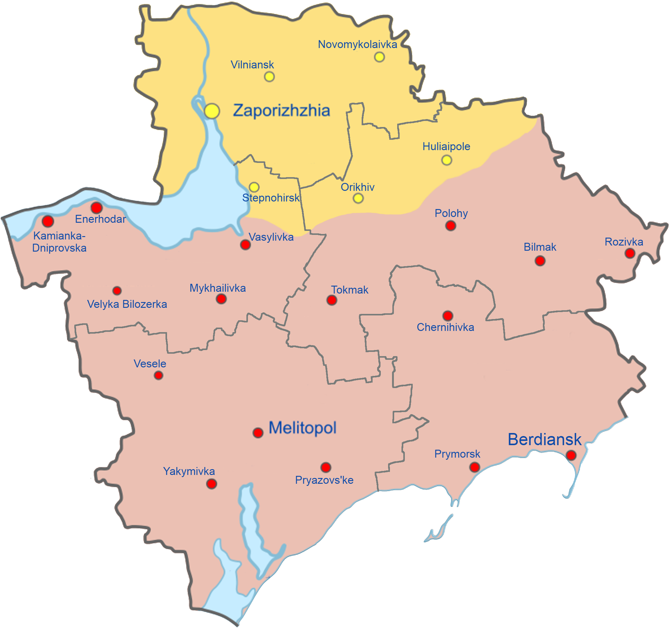
English: Map of Zaporizhzhia Oblast showing the rough zones of occupation during the southern offensive of the 2022 Russian invasion of Ukraine, as of August 2022.
Ukraine ( ) has maintained control over the north of the oblast, including the areas around the cities of Zaporizhzhia, Huliaipole and Orikhiv. The Russian occupation ( ) extends throughout the entire southern part of the oblast, including the major cities of Melitopol, Berdiansk and Enerhodar. |
| Date | 2022-06-26 |
| Source | Own work |
| Author | Qexypnos |
| ⧼wm-license-information-other-versions⧽ | قالب:Ukraine Regional Occupation Mapsقالب:Derivative versions |

|
أحداث هذه المقالة هي أحداث جارية. المعلومات المذكورة قد تتغير بسرعة مع تغير الحدث. |
ترخيص
|


تاريخ الملف
اضغط على زمن/تاريخ لرؤية الملف كما بدا في هذا الزمن.
| زمن/تاريخ | صورة مصغرة | الأبعاد | مستخدم | تعليق | |
|---|---|---|---|---|---|
| حالي | ★ مراجعة معتمدة 21:53، 1 ديسمبر 2023 | | 2٬210 × 2٬076 (781 كيلوبايت) | Pastakhov (نقاش | مساهمات) | Upload https://upload.wikimedia.org/wikipedia/commons/1/10/Zaporizhzhia_region.png |
لا يمكنك استبدال هذا الملف.
وصلات
لا يوجد صفحات تصل لهذه الصورة.
