ملف:Winyah Bay.jpeg

حجم هذه المعاينة: 621 × 600 بكسل. البعدان الآخران: 2٬120 × 2٬048 بكسل | 3٬939 × 3٬805 بكسل.
الملف الأصلي (3٬939 × 3٬805 بكسل حجم الملف: 3٫9 ميجابايت، نوع MIME: image/jpeg)
وصف قصير
| Description |
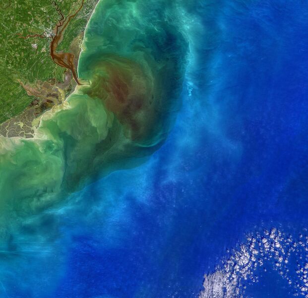
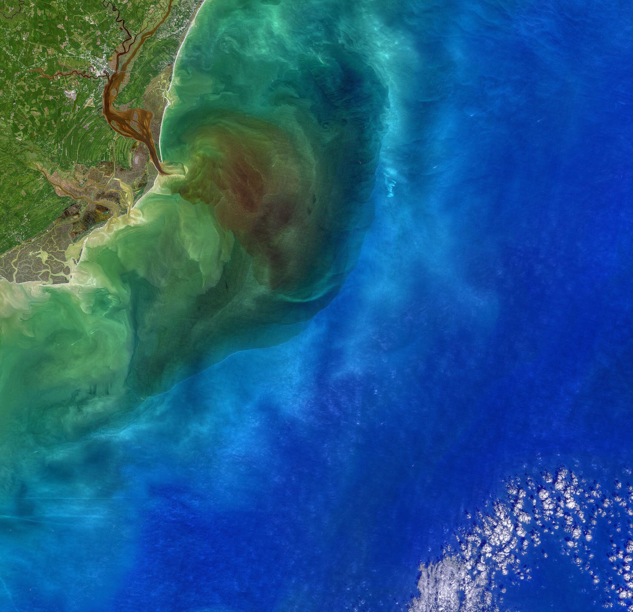
Four blackwater rivers—the Waccamaw, Pee Dee, Black, and Sampit—feed into Winyah Bay, an estuary in eastern South Carolina. All of them flow through swamps, wetlands, and forests that are rich with decaying vegetation and other organic matter. The dead leaves and debris stain the rivers and wetlands a transparent brown color as several natural chemical substances found in plants—tannin, phenol, and humic acid—seep into the water. The same process gives tea its yellow or brown color. After heavy rains, stained floodwaters can get flushed out of swamps and wetlands into the estuary and ocean. That was happening on October 1, 2020, when the Operational Land Imager (OLI) on Landsat 8 acquired this natural-color image of Winyah Bay. Many waterways were swollen following heavy rains from Hurricane Sally. |
| Date | 2020-10-01 |
| Source | https://earthobservatory.nasa.gov/images/147517/stained-winyah-bay |
| Author | NASA image by Norman Kuring/NASA's Ocean Color Web, using Landsat data from the U.S. Geological Survey. Story by Adam Voiland, with information from James Morris (University of South Carolina). |
ترخيص
تاريخ الملف
اضغط على زمن/تاريخ لرؤية الملف كما بدا في هذا الزمن.
| زمن/تاريخ | صورة مصغرة | الأبعاد | مستخدم | تعليق | |
|---|---|---|---|---|---|
| حالي | ★ مراجعة معتمدة 08:45، 28 نوفمبر 2023 | | 3٬939 × 3٬805 (3٫9 ميجابايت) | Pastakhov (نقاش | مساهمات) | Upload https://upload.wikimedia.org/wikipedia/commons/d/d0/Winyah_Bay.jpeg |
لا يمكنك استبدال هذا الملف.
وصلات
لا يوجد صفحات تصل لهذه الصورة.