ملف:Wells Mews - geograph.org.uk - 1311402.jpg
حجم هذه المعاينة: 450 × 600 بكسل. البعد الآخر: 480 × 640 بكسل.
الملف الأصلي (480 × 640 بكسل حجم الملف: 77 كيلوبايت، نوع MIME: image/jpeg)
وصف قصير
| Description |
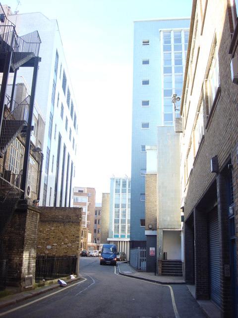
English: Wells Mews, London
These mews, seen from the opposide direction, were used as a location for the Agatha Christie's Poirot episode "The Kidnapped Prime Minister" (1990). The white building on the left doubled as Commander Daniels' residence. |
| Date | 2009-05-11 |
| Source | From geograph.org.uk |
| Author | Oxyman |
| ⧼wm-license-cc-attribution⧽ (قالب:I18n/Credit line) |
Oxyman / Wells Mews / |
51°31′02″N 0°08′12″W / 51.51730°N 0.1367°W
_heading:337)
| Object location | ملف:Compass-icon bb NNW.svg | View all coordinates using: OpenStreetMap |
|---|
_heading:337.00&language=⧼lang⧽)
ترخيص
تاريخ الملف
اضغط على زمن/تاريخ لرؤية الملف كما بدا في هذا الزمن.
| زمن/تاريخ | صورة مصغرة | الأبعاد | مستخدم | تعليق | |
|---|---|---|---|---|---|
| حالي | ★ مراجعة معتمدة 14:45، 28 نوفمبر 2023 | | 480 × 640 (77 كيلوبايت) | Pastakhov (نقاش | مساهمات) | Upload https://upload.wikimedia.org/wikipedia/commons/5/50/Wells_Mews_-_geograph.org.uk_-_1311402.jpg |
لا يمكنك استبدال هذا الملف.
وصلات
لا يوجد صفحات تصل لهذه الصورة.