ملف:Victoria Bridge - geograph.org.uk - 1219825.jpg
لا توجد دقة أعلى متوفرة.
Victoria_Bridge_-_geograph.org.uk_-_1219825.jpg (640 × 480 بكسل حجم الملف: 58 كيلوبايت، نوع MIME: image/jpeg)
وصف قصير
| Description |
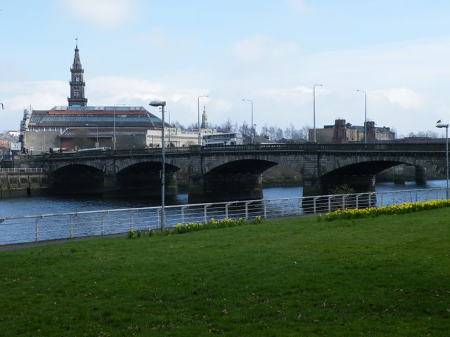
English: Victoria Bridge Links The Gorbals to the city centre. The building with the tower is the Briggait Centre, a former fish market which is currently being renovated. |
| Date | 2009-03-21 |
| Source | From geograph.org.uk |
| Author | Thomas Nugent |
| ⧼wm-license-cc-attribution⧽ (قالب:I18n/Credit line) |
Thomas Nugent / Victoria Bridge / |
55°51′12″N 4°15′09″W / 55.85336°N 4.2525°W
_heading:67)
| Object location | ملف:Compass-icon bb ENE.svg | View all coordinates using: OpenStreetMap |
|---|
_heading:67.00&language=⧼lang⧽)
ترخيص
تاريخ الملف
اضغط على زمن/تاريخ لرؤية الملف كما بدا في هذا الزمن.
| زمن/تاريخ | صورة مصغرة | الأبعاد | مستخدم | تعليق | |
|---|---|---|---|---|---|
| حالي | ★ مراجعة معتمدة 02:04، 30 أكتوبر 2023 | | 640 × 480 (58 كيلوبايت) | Pastakhov (نقاش | مساهمات) | Upload https://upload.wikimedia.org/wikipedia/commons/4/48/Victoria_Bridge_-_geograph.org.uk_-_1219825.jpg |
لا يمكنك استبدال هذا الملف.
وصلات
لا يوجد صفحات تصل لهذه الصورة.