ملف:US map-Northeast.PNG
لا توجد دقة أعلى متوفرة.
US_map-Northeast.PNG (572 × 371 بكسل حجم الملف: 16 كيلوبايت، نوع MIME: image/png)

|
[All images in this gallery should be recreated using vector graphics as an SVG file. This has several advantages; see Commons:Media for cleanup for more information. If an SVG form of this image is already available, please upload it. After uploading an SVG, replace this template with {{vector version available|new image name.svg}}.] Error: {{Lang}}: text has italic markup (help) |
|
العربية | български | català | čeština | dansk | Deutsch | English | Esperanto | español | français | galego | 한국어 | italiano | magyar | lietuvių | 日本語 | Plattdüütsch | Nederlands | norsk | polski | português | română | русский | suomi | svenska | Türkçe | українська | 中文(繁體) | 中文(简体) | +/− | |
وصف قصير
| Description |
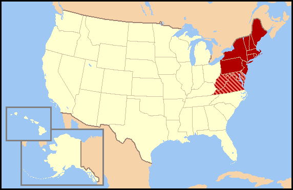
This map was commissioned by WikiProject U.S. regions. Regional definitions vary from source to source and this map does not attempt to favor a single definition. There are most likely definitions that differ from yours so, please do not make changes to this map without discussing them on WikiProject U.S. regions' talk page. en:Wikipedia:WikiProject U.S. regions/mnote JCarriker@en.Wikipedia.org made this from the exisiting image , which is also released under GNU. |
| Date | 2005-12-12 |
| Source | en:Image:US map-Northeast.PNG |
| Author | en:User:JCarriker |
| ⧼wm-license-information-permission⧽ (⧼wm-license-information-permission-reusing-text⧽) |
hui |
ترخيص
تاريخ الملف
اضغط على زمن/تاريخ لرؤية الملف كما بدا في هذا الزمن.
| زمن/تاريخ | صورة مصغرة | الأبعاد | مستخدم | تعليق | |
|---|---|---|---|---|---|
| حالي | ★ مراجعة معتمدة 17:54، 13 يوليو 2025 | | 572 × 371 (16 كيلوبايت) | Pastakhov (نقاش | مساهمات) | Upload https://upload.wikimedia.org/wikipedia/commons/0/0c/US_map-Northeast.PNG |
لا يمكنك استبدال هذا الملف.
وصلات
لا يوجد صفحات تصل لهذه الصورة.