ملف:Two Bridges Cross The Laira - geograph.org.uk - 293055.jpg
لا توجد دقة أعلى متوفرة.
Two_Bridges_Cross_The_Laira_-_geograph.org.uk_-_293055.jpg (640 × 480 بكسل حجم الملف: 71 كيلوبايت، نوع MIME: image/jpeg)
وصف قصير
| Description |
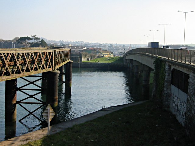
English: Two Bridges Cross The Laira The Laira is the name for the estuarine stretch of the River Plym above The Cattewater. Here it's at its narrowest. On the left is an old decaying railway bridge and on the right, the four lane road bridge taking traffic between Plymouth and the large suburb of Plymstock. |
| Date | 2003-02-15 |
| Source | From geograph.org.uk |
| Author | Tony Atkin |
| ⧼wm-license-cc-attribution⧽ (قالب:I18n/Credit line) |
Tony Atkin / Two Bridges Cross The Laira / |
50°22′12″N 4°06′36″W / 50.3699°N 4.110°W
_heading:135)
| Object location | ملف:Compass-icon bb SE.svg | View all coordinates using: OpenStreetMap |
|---|
_heading:135.00&language=⧼lang⧽)
ترخيص
تاريخ الملف
اضغط على زمن/تاريخ لرؤية الملف كما بدا في هذا الزمن.
| زمن/تاريخ | صورة مصغرة | الأبعاد | مستخدم | تعليق | |
|---|---|---|---|---|---|
| حالي | ★ مراجعة معتمدة 09:45، 6 أكتوبر 2023 | | 640 × 480 (71 كيلوبايت) | Pastakhov (نقاش | مساهمات) | Upload https://upload.wikimedia.org/wikipedia/commons/d/d4/Two_Bridges_Cross_The_Laira_-_geograph.org.uk_-_293055.jpg |
لا يمكنك استبدال هذا الملف.
وصلات
لا يوجد صفحات تصل لهذه الصورة.