ملف:Tiger Bush Niger Corona 1965-12-31.jpg
حجم هذه المعاينة: 600 × 600 بكسل. البعد الآخر: 1٬000 × 1٬000 بكسل.

الملف الأصلي (1٬000 × 1٬000 بكسل حجم الملف: 545 كيلوبايت، نوع MIME: image/jpeg)
وصف قصير
| Description |
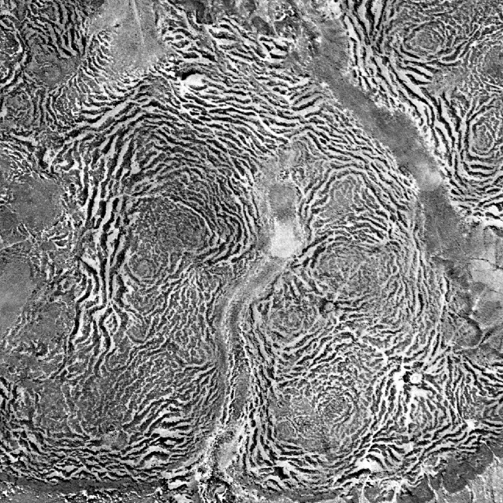
English: Vertical aerial view of a tiger bush plateau in Niger. Vegetation is dominated by Combretum micranthum and Guiera senegalensis. Image size : 5 x 5 km on the ground. Satellite image from the Declassified corona KH-4A national intelligence reconnaissance system, 1965-12-31.
Français : Vue aérienne verticale d'une brousse tigrée au Niger le 31 décembre 1965. La végétation est dominée par Combretum micranthum et Guiera senegalensis. L'image couvre 5 x 5 km de terrain. Image satellite Corona KH-4A déclassifiée. |
| Date | 1965-12-31 |
| Source | Data available from the U.S. Geological Survey |
| Author | US Agency |
Coordinates: Missing latitude
تم تمرير الوسائط غير الصالحة إلى الدالة {{#coordinates:}} function
ترخيص
 |
This image is a work of a United States Geological Survey employee, taken or made as part of that person's official duties. As a work of the United States Government, the image is in the public domain in the US. For more information, see the USGS copyright policy. See Wikipedia:Public domain and Wikipedia:Copyrights for more details. |  |
تاريخ الملف
اضغط على زمن/تاريخ لرؤية الملف كما بدا في هذا الزمن.
| زمن/تاريخ | صورة مصغرة | الأبعاد | مستخدم | تعليق | |
|---|---|---|---|---|---|
| حالي | ★ مراجعة معتمدة 10:00، 14 ديسمبر 2023 | | 1٬000 × 1٬000 (545 كيلوبايت) | Pastakhov (نقاش | مساهمات) | Upload https://upload.wikimedia.org/wikipedia/commons/1/1b/Tiger_Bush_Niger_Corona_1965-12-31.jpg |
لا يمكنك استبدال هذا الملف.
وصلات
الصفحات التالية تحتوي على وصلة لهذه الصورة:
