ملف:Staines from the air.jpg
لا توجد دقة أعلى متوفرة.
Staines_from_the_air.jpg (640 × 480 بكسل حجم الملف: 268 كيلوبايت، نوع MIME: image/jpeg)
وصف قصير
| Description |
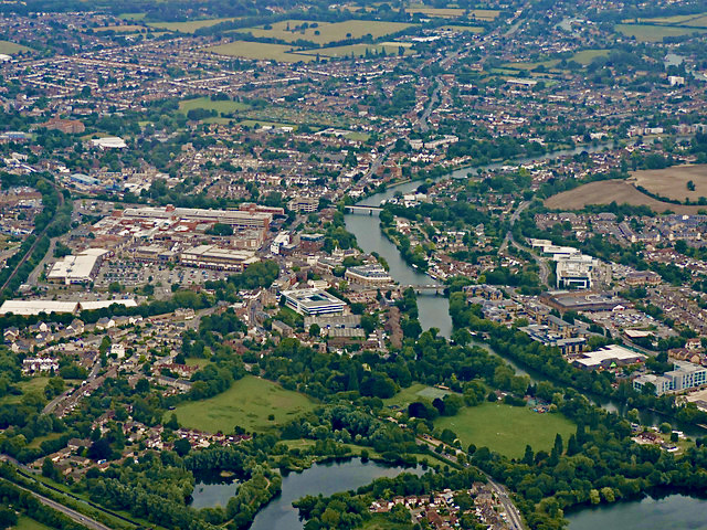
English: Staines-upon-Thames (left) and Egham Hythe (right) viewed from the west. Staines Bridge is the bridge nearest the camera and the railway bridge on the Staines-Reading line is in the distance. |
| Date | 2015-08-03 15:54:20 |
| Source | From geograph.org.uk |
| Author | Thomas Nugent |
| ⧼wm-license-information-permission⧽ (⧼wm-license-information-permission-reusing-text⧽) |
Creative Commons Attribution Share-alike license 2.0 |
| ⧼wm-license-cc-attribution⧽ (قالب:I18n/Credit line) |
Thomas Nugent / Staines from the air / |
| Object location | ملف:Compass-icon bb SSE.svg | View all coordinates using: OpenStreetMap |
|---|
_heading:157.00&language=⧼lang⧽)
ترخيص
تاريخ الملف
اضغط على زمن/تاريخ لرؤية الملف كما بدا في هذا الزمن.
| زمن/تاريخ | صورة مصغرة | الأبعاد | مستخدم | تعليق | |
|---|---|---|---|---|---|
| حالي | ★ مراجعة معتمدة 10:03، 30 أكتوبر 2023 | | 640 × 480 (268 كيلوبايت) | Pastakhov (نقاش | مساهمات) | Upload https://upload.wikimedia.org/wikipedia/commons/f/f8/Staines_from_the_air.jpg |
لا يمكنك استبدال هذا الملف.
وصلات
لا يوجد صفحات تصل لهذه الصورة.